Superlative Walks
Urban and rural trails, each with something very specialMANCHESTER: CAMPUS TO QUAYS – DIRECTIONS AND ADDED INFORMATION
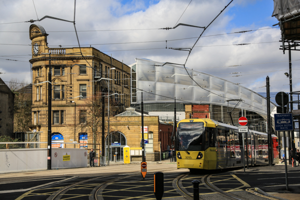
1. To begin, take the tram, either from a City Centre location or from the end point of the walk, at Salford Quays, to the West of the City Centre. Head east out of the City, on the Ashton line, to the Etihad Campus.
2. As a warm-up exercise for the start of the walk, climb the steps up from the tram stop and view the stadium from all sides by walking round it, clockwise or anti-clockwise as you wish.
More Information
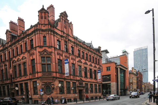
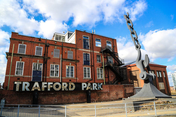
The Etihad Campus is the central part of Manchester’s Sportscity, built to host the Commonwealth Games in 2002 and now home to Manchester City Football Club.
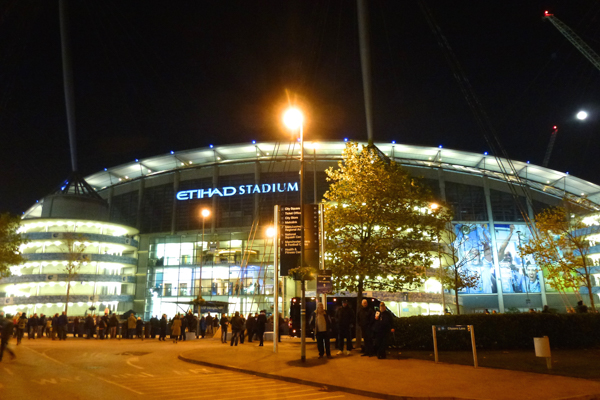
Etihad Stadium
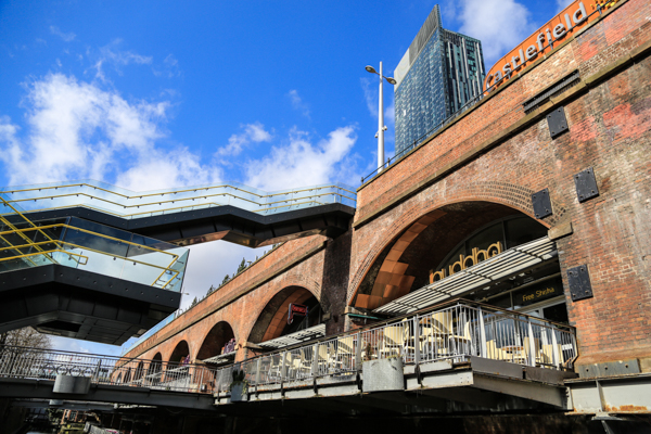
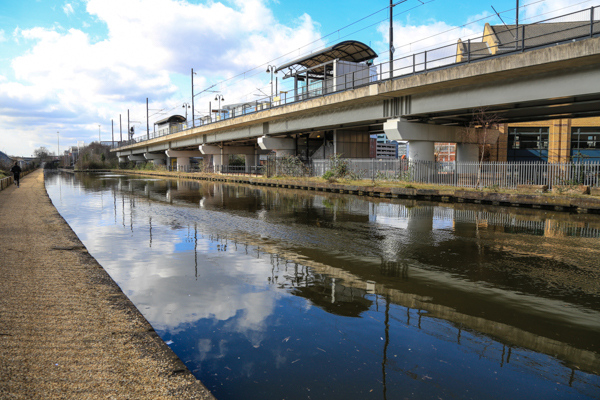
3. Having circumnavigated, look for the blue bridge (unmistakeable as a large bridge surfaced in bright blue. From the stadium it seems to lead towards a gasometer. Do not cross the bridge entirely. Just after the bridge crosses the tram tracks and the canal, take the steps on the left down to the towpath.
Picture
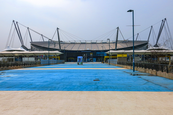
Blue Bridge – Etihad Campus
4. The route now follows the canal towpath.
More Information
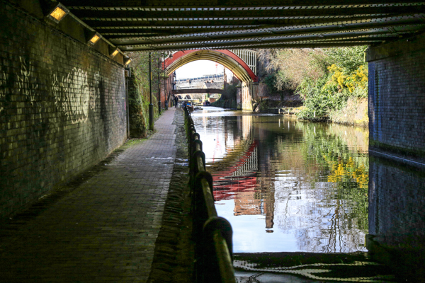
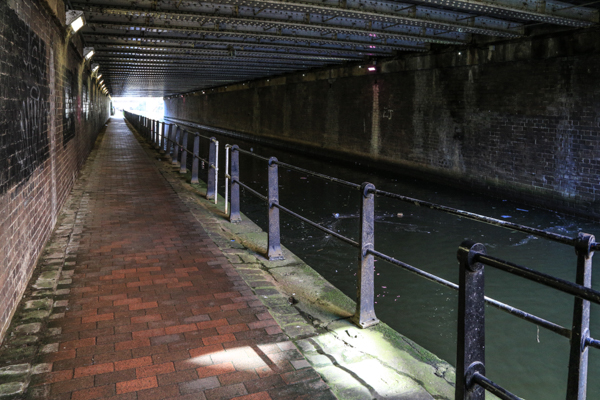
The Towpath runs beneath a variety of bridges, with some colourful decay, past a few new housing developments and some mills, mostly either wholly or partly deserted. This area of East Manchester has suffered from serious depopulation over recent decades. Regeneration activity has started to reverse that but there is patently much more still to do.
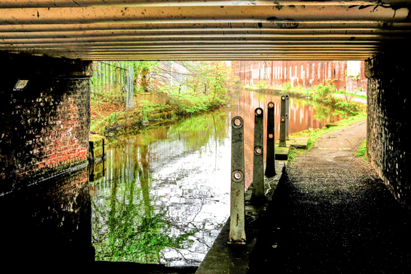
Ashton Canal Towpath
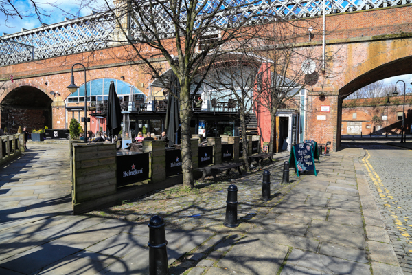
5. After about a mile, approach a brightly coloured building on the right of the canal.
More Information
This is “Chips” designed by Will Alsop and developed by Urban Splash. It has three horizontal layers, each of a different colour and slightly overlapping and each containing three floors of apartments, with business units on the ground floor level. The three layers are said each to be reminiscent of a potato chip.
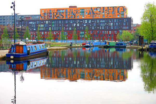
CHIPS
6. Walk along the towpath to the far end of the Chips building and then immediately turn right. Do not continue on to cross the yellow, Dutch-style lifting bridge. Follow the path across the City end of Chips and across the low swing bridge over the canal arm.
Picture
Across the canal arm by CHIPS
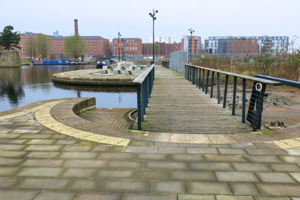
7. Cross the road ahead. To the right of the canal basin enter “Cotton Fields” through a gate.
More Information
“Cotton Fields” is new eco-park, seeking to use nature to bring people together within an urban environment. It consists of a new body of water, moorings for canal boats, a boardwalk, an ‘urban beach’ and distinctive islands. Extensive planting includes an orchard island, a protective grove of Scots Pines around the beach, and wildflowers and reed beds, all helping to attract wildlife.
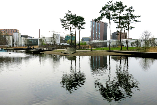
Cotton Fields
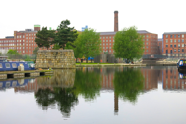
8. Walk along the right of the basin past a wider section and then cross a footbridge to the left of the basin. After the bridge turn right and walk towards the red brick mills of Ancoats.
More Information
The mills of Ancoats, now an “Urban Village,” were the world’s first heavily industrialised suburb, built between 1790 and 1820. The nineteenth century industrial “golden age” is often romanticised but living and working conditions were atrocious, with child labour, poverty and disease. Ancoats had the highest death rate in Manchester which in turn had the highest death rate in England.
Ancoats from Cotton Fields
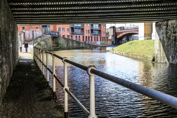
9. At the Ancoats end of the Cotton Fields basin, the Rochdale Canal is reached. Turn left along the Rochdale Canal towpath. Cross the shapely old footbridge to the Ancoats side of the Canal. After the bridge, turn right and walk back along Redhill Street passing, on your left Royal Mills and Union Mill.
More Information
Note the high level bridge between the two mills across Murray Street.
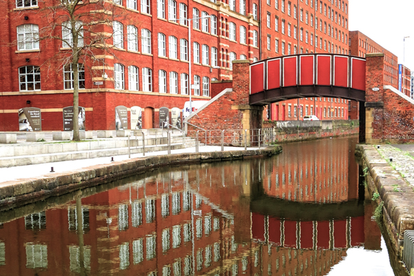
Redhill Street
10. After Murray Street turn left, opposite a new canal footbridge into Bengal Street.
More Information
On the left of Bengal Street is Murray’s Mills. Through a mesh fence you can see the Murray’s complex of tall mill buildings, a small mill lodge and some domestic scale buildings. These are the oldest surviving mills in the region, built in 1798.
Murray’s Mills
11. Further along Bengal Street, after crossing Jersey Street, turn left into Hood Street.
More Information
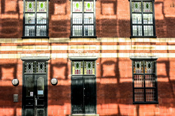
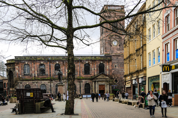
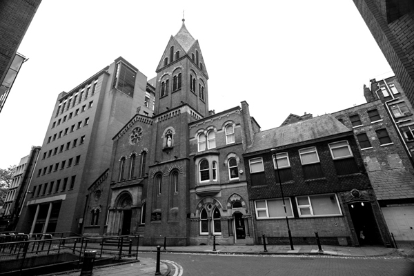
On the right is St Peter’s Church, an Italian Romanesque Church built in 1859 and which seated 1350 worshippers. Restored in 1998, it is now a rehearsal space for the Halle Orchestra. Past St Peter’s is a square with tall glass panels and a scatter of models of cotton bales. This is known as Cutting Room Square. The Square is watched over by five giant monoliths. Each frames an enlarged photograph by Ancoats artist-in-residence Dan Dubowitz. To the far side is a pleasant cafe, the Koffee Lock, on Blossom Street.

St Peter’s Church
12. Leaving, or passing, the cafe turn left into Sherratt Street, opposite the entrance to St Peter’s. After crossing Loom Street the next street is George Leigh Street.
More information.
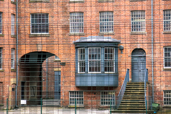
Across George Leigh Street, to the right, is the five storey, rectangular block of Victoria Square. This was built in 1897 as a major slum replacement scheme, Manchester’s first municipal housing, with 235 two room and 48 single room flats. It is still used as publicly owned housing.
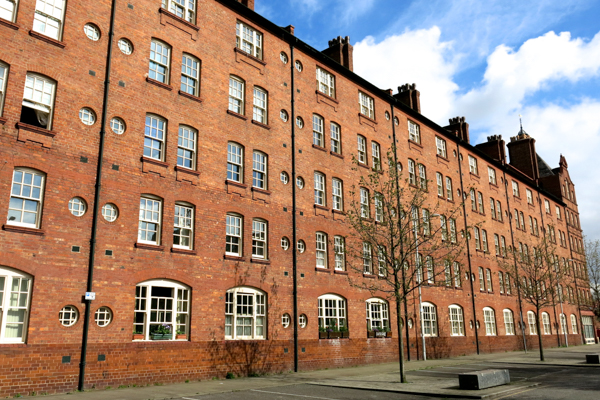
Victoria Square
13. To the left of Victoria Square, walk along George Leigh Street, past some parallel terraces of three-bedroomed houses.
More information.
These terraces were built at the same time as Victoria Square but were far too expensive for working class families at the time. Parallel to George Leigh Street is Anita Street. This was originally called “Sanitary Street.” In the 1950s local residents campaigned for a change of name. The Council came up with the simple idea of deleting three letters from “Sanitary” to leave “Anita.”
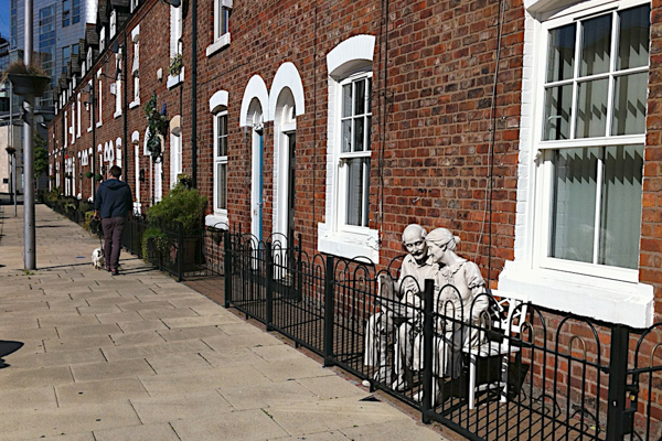
Anita Stree
14. Walk along Anita Street and, at its end, turn left into Cornell Street and then right, into George Leigh Street.
More Information
At the end of George Leigh Street, on the left, is the former Methodist Women’s Night Shelter. Pevsner says it was opened in 1899 with a coffee tavern on the ground floor, whilst the rest was a night shelter, a home for women needing further care and attention and a home for domestic servants, offered as an alternative to the moral perils of the lodging house.
On the right is the mirrored glass and steel of the former Daily Express building, fronting on to Great Ancoats Street. From 1939 until the 1980s, the paper was printed here. The presses in the triple height press hall were, it is said, an impressive sight, particularly when lit up at night.
Methodist Women’s Night Shelter
15. Cross Great Ancoats Street, at the pedestrian crossing, to leave Ancoats and enter the Northern Quarter.
More information.
The “Northern Quarter” was branded as such in the mid-1990s. The area is popular for its numerous bars and cafes and its mix of music and clothes shops. Amongst these is Affleck’s Palace, a former department store which has been turned into a multi-storey “alternative” bazaar. The Quarter has a vibrant nightlife with trendy cafes, bars and music venues.
The area is a home to the creative industries, and in particular fashion design, with a number of commercial art galleries. Additionally, due to the area’s architecture, the Northern Quarter has been used at various times as filming locations, often as parts of New York. In November 2010 the area was awarded the Great Neighbourhood of the Year Award 2011 for Britain and Ireland at the Academy of Urbanism Awards in London.
The area is best explored by aimless wandering. However, to progress this, more purposeful, walk the route follows a zig-zag course through many of the Quarter’s notable streets as well as a few of its quieter ones.
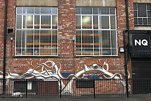
Northern Quarter
16. Having crossed Great Ancoats Street, enter Lever Street. Take the second right into Warwick Street.
More information.
On the right of Lever Street which is The Hive, an office development for creative industries.
Lever Street

Lever Street
17. Continue along Warwick Street, across Spear Street to Oldham Street. Stay on Warwich Street which becomes Whittle Street to cross Tib Street. Whittle Street widens just before the Wheatsheaf Pub.
Pictures
Oldham Street

Wheat Sheaf Hotel
18. Just after the Wheatsheaf, turn left into Oak Street.
More information.
On the right is the Manchester Craft and Design Centre, in the former retail fish market. If it is open, walk through the centre to see some of the craft shops and galleries and perhaps visit the cafe.
Craft and Design Centre
19. At the far end of the Centre turn left out into William Fairburn Way/Hare Street and then immediately right into Copperas Street.
Picture
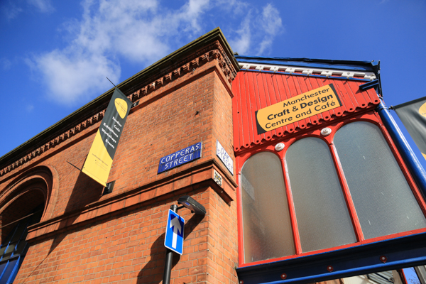
Copperas Street
20. At the far end of Copperas Street turn left into High Street.
More information.
On the right is the Manchester Craft and Design Centre, in the former retail fish market. If it is open, walk through the centre to see some of the craft shops and galleries and perhaps visit the cafe.
Markets on High Street
21. Turn right into Thomas Street. After passing Salmon Street on the right cross the busy Shudehill to the transport interchange. To its left is the Metrolink stop. Cross to the left of that and walk along the footway down its left hand side. Then cross Dantzic Street into Balloon Street.
More information.
On the right is the Manchester Craft and Design Centre, in the former retail fish market. If it is open, walk through the centre to see some of the craft shops and galleries and perhaps visit the cafe.
Balloon Street from Shudehill
22. Follow the tram tracks across Corporation Street and into Victoria Station
More information.
Victoria, which has recently undergone a major restoration, was opened in 1844 by the Liverpool and Manchester Railway and the Manchester and Leeds Railway. The original building, the L shaped block on the corner of Hunts Bank Approach and Victoria Station Approach was designed by Robert Stephenson.
Victoria Station
Victoria Station
23. Walk through the ticket hall to the opening to the left, away from the platforms, to view the large tiled “Lancashire and Yorkshire Railway map of destinations accessible from Victoria.
More information.
The map omitted lines run by rival operators and so misled travellers to make unnecessarily complex journeys.
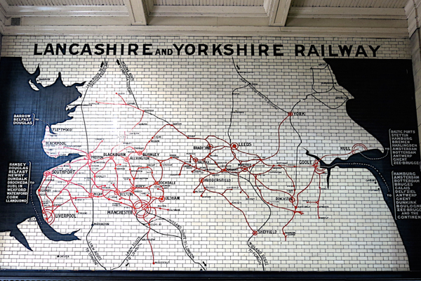
Victoria Station Map
24. Walk out onto Victoria Station Approach.
More information.
Opposite the entrance is part of the modern extension to Chetham’s School of Music.

Modern extension to Chetham’s
25. Turn left along Victoria Station Approach.
More information.
Noticing on the left a glazed canopy with some of the original destinations served from the station. Where the approach opens out into Cathedral Gardens, ahead of you is the “Urbis” building, by Ian Simpson Architects in 2000-1. It is described by Pevsner as shaped like a rearing transparent prow and clad in textured semi-translucent glass. It originally housed a poorly-conceived exhibition “exploring the experience of the modern city.” That closed in 2010 and reopened as the National Football Museum in 2012.
To the right is the entrance to the Chetham’s complex at the heart of which are an original 15th century manor house surrounded by Tudor structures. They have been used as a religious college, a civil war armoury and became a charity school in 1653. It became a boys’ grammar school in 1952 and developed music as a speciality, becoming Chetham’s School of Music in 1969.

Canopy on Victoria Station Approach
National Football Museum
26. Walk across the gardens by the paved Long Millgate, with a grassed area (with football-themed play equipment and an artificial stream) to your left.
More information.
To the right is the entrance to the Chetham’s complex at the heart of which are an original 15th century manor house surrounded by Tudor structures. They have been used as a religious college, a civil war armoury and became a charity school in 1653. It became a boys’ grammar school in 1952 and developed music as a speciality, becoming Chetham’s School of Music in 1969.
Chetham’s School of Music
27. Continue into Cathedral Street, which runs to the rear of Manchester Cathedral.
More information.
This Gothic church is the widest in England, the present building being built in 1422-1458 out of Collyhurst sandstone.
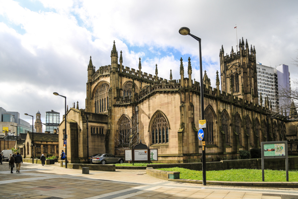
Manchester Cathedral
28. Immediately after passing the Cathedral, turn right into Cathedral Yard and then left into Cathedral Passage. This brings you to an area surrounded on three sides by pubs – the Mitre, the Old Wellington and Sinclair’s Oyster Bar.
More information.
The Old Wellington is Manchester’s oldest pub, dating back to 1550. It and Sinclairs survived severe bombing in World War 2, when they were situated in Market Place. When that area was redeveloped in the early 1970s the pubs were raised by five feet to allow a slip road to be built beneath. Following the IRA bomb in 1996, the pubs were damaged but repaired. To make way for the post-bomb redevelopment, including the massive building now shared by Marks and Spencer and Selfridges, the pubs were dismantled into over 10,000 items and reassembled 200 yards to the north, in their present location.
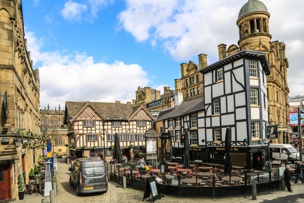
Mitre, Old Wellington and Sinclairs
29. Walk between the pubs and up the steps opposite then along New Cathedral Street, a new “up-market” shopping street built in the post-bomb phase.
Pictures
New Cathedral Street

New Cathedral Street
30. Cross St Mary’s gate at the end, with the front of Marks and Spencer to the left and enter Exchange Street.
More information.
To the left is the grand classical Edwardian exterior of the Royal Exchange. The current building was built in 1806-9 and extended in 1847-9. For a time, the Exchange controlled about 80% of the world’s cotton trade. It continued trading until 1968, was closed until 1973 and then used as a temporary theatre. This was transformed into a substantial, modern theatre “in the round” – more accurately a seven sided steel and glass structure – which opened as a theatre in 1976. It was severely damaged in the 1996 IRA bomb but then restored, improved and reopened in 1998. Access to visit the interior, which is possible except during performances, is via the modern glazed staircase and lift.
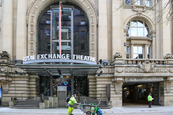
Royal Exchange Theatre
31. Exchange Street opens out into St Ann’s Square.
More information.
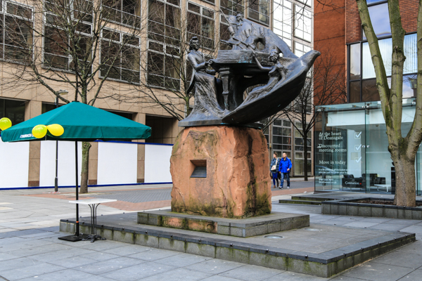
This smart and pleasant squares was the site of an annual fair from 1222 until 1823 when it was moved following complaints from shopkeepers about marauding pigs and cows. Bonnie Prince Charlie’s troops gathered here in December 1745. In 1832 it was the site of the first election of Manchester MPs, by a show of hands. St Ann’s Church at the far end was built in 1709-12. The centre of the Square has a memorial to the Boer War, built in 1908, and beyond is a statue of Richard Cobden, who appears to be studying his mobile phone.
St Ann’s Square
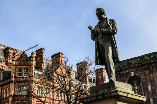
Cobden studies his mobile phone
32. Walk around St Ann’s Church to the right and at its far side go through St Ann’s Passage. Turn right into King Street, another fashionable shopping street. Walk to the junction with Deansgate.
More information.
On the far side, to the right, is the “House of Fraser” store. A store first opened near here in 1796 and later moved to its present site. It was bought by Kendal, Milner and Faulkner in 1835 and expanded across Deansgate into what is now Waterstone’s, the two sites being connected by an underground passage. The current Art Deco style building was built in 1939.
St Ann’s Passage
33. Cross to the far side of Deansgate and turn left along it, passing King Street West, Bridge Street and Wood Street. Then, on the right, is the ornate, red sandstone, neo-Gothic, John Rylands Library.
More information.
The John Rylands Library was built in 1890-99 from the fortune of the cotton millionaire John Rylands, under the direction of his wife Enriqueta Augustina Rylands It has a massive collection of ancient documents. It is owned by Manchester University and open to the public via a well-integrated modern extension to the rear, built in 2004-7.The Rylands Library sits at the entrance to the Spinningfields development, developed in the early 21st Century as a new business district with offices for banks, lawyers, accountants, etc.

John Rylands Library
34. Leaving the Library cross the open square to its South side, past the awkward angled building and turn right down The Avenue. This leads to Crown Square.
More information.
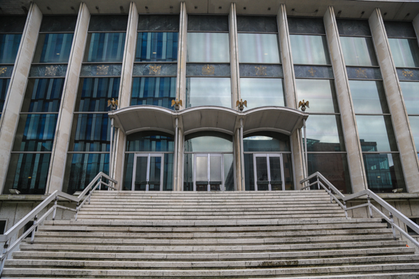
Facing you in Crown Square is the Crown Court, built in what seems to be a neo-Fascist style in 1957-62.
Crown Court
35. Turn right out of the Avenue, passing to the right of the Oast House pub, along Dolefield to Bridge Street. There turn left and left again into Gartside Street to walk along the looming South-East side of the Civil Justice Centre,
More information.
Looming above is the Civil Justice Centre, a huge construction in coloured glass and steel with floors that jut out like filing cabinet drawers, built at a cost of £160 million and completed in 2007. During office hours the building can be visited, with a lift to the top floor leading to fine views – but no photography.

Civil Justice Centre
36. Beyond the end of the Civil Justice Centre, bear slightly right into New Gartside Street and then turn left into Hardman Square.
Picture

Hardman Square
37. Walk through Hardman Square, bearing slightly to the left and enter Hardman Street, which leads back to Deansgate.
Picture
Deansgate
38. Cross back to the east side of Deansgate, to the statue of Chopin at the end of Brazenose Street.
Picture
Chopin in Brazenose Street
39 Turn right up Brazenose Street into Lincoln Square. Leave the square to the left through an unattractive low covered passageway that leads to Mulberry Street.
More information.
Opposite the passageway, in Mulberry Street, beyond some metal barriers is Manchester’s “Hidden Gem” – the Roman Catholic Church of St Mary, built in 1848 to a “Rhenish-Romanesque” design by Weightman and Hadfield that outraged Pugin who wrote that it “shows to what depth of error even good men fall, when they go whoring after strange styles.”
Hidden Gem
40. Return to Lincoln Square and turn left towards the Town Hall, clearly visible beyond the end of the street. Cross the road into Albert Square.
More information.
In the centre is a memorial to Prince Albert, built in 1862-7. It was cleaned in the 1970s after some Councillors asked for it to be destroyed. The Town Hall was built in 1868-77, designed by Alfred Waterhouse as one of the finest neo-Gothic buildings in the country, on an unusual triangular site. To the right of the Town Hall is the Town Hall Extension built in 1934-8, with a mixture of styles which complement but do not attempt to outdo the Gothic splendour of the Town Hall itself. The Council refurbished the Town Hall Extension and the Central Library from 2010-5. The public entrances on Mount Street and St Peter’s Square were restored to their 1930s appearance and staircases to the lower ground floor were reinstated to access the Central Library which was extended into the basement. The rates hall was restored.
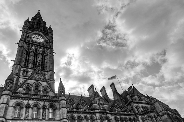
Town Hall
41. Walk past the extension to the right, along Mount Street to the junction with Peter Street. Turn left into Peter Street and walk into St Peter’s Square.
More information.
On the left is the massive Central Library with a dome said to rival the Pantheon. At the time of writing the Library had recently re-opened after a £50 million refurbishment. The interior of the building has some interesting old features and the reading room, beneath the dome is impressive.

Central Library
42. Leaving the library turn right and follow the tram tracks, to the left of the Midland Hotel along Lower Mosely Street.
More information.
The brick, granite and terracotta Midland Hotel was built in 1898-1903, by the Midland Railway Company (whose Central Station – now the Manchester Central exhibition centre – is to the rear). At the time it was Manchester’s finest hotel. There are many stories about famous guests. For example, Rolls met Royce in the Grill Room in 1904 and agreed to start a business. Laurence Olivier stayed at the hotel during the filming of Granada TV’s Brideshead Revisited. Early one morning, a fire alarm went off. Brideshead’s producer knocked on Olivier’s door:
“Larry, Larry, there appears to be a fire.”
“Really? Oh, bad luck. Do let me know if there’s anything I can do,” he replied and shut the door.
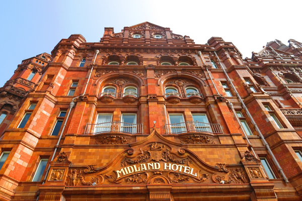
Midland Hotel
43. Cross to the left of the Street to Barbirolli Square.
More information.
The sandstone, steel and glass Bridgewater Hall, the City’s classical concert hall, was built in 1993-6. It is mounted on 270 giant foundation springs, to protect it from the noise or nearby trams and trains. The prow shape of the facade symbolises Manchester’s maritime past. It was originally to be called the Barbirolli Hall, after the legendary Halle Orchestra conductor but Bridgewater was chosen. In the Square is a big, smooth pebble sculpture – Touchstone by Kan Yasuda.
Bridgewater Hall
44. Beyond this, to the left some steps lead steeply down to a small canal basin. Walk down there and follow the path around the right of the basin and then alongside a small, narrow stretch of canal, beneath Bridgewater Street and emerging by the Rochdale Canal.
More information.
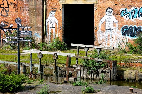
This short canal is all that remains of the Manchester and Salford Junction Canal, built in 1839 to link the Rochdale Canal to the River Irwell. It was built as a short cut, to allow boaters to pay charges at the Hulme Locks but it was always short of water and closed in 1936.
Manchester and Salford Canal
45. Turn right at the lock ahead as you emerge from the tunnel and cross the footbridge to the towpath on the far side. Turn right on the far side and follow the towpath.
More information.
A block of apartments on the left was built on the site of the former Hacienda nightclub. The club opened in 1982 and, despite considerable problems with drug gangs, survived until 1997. It was mostly financed by Factory Records, the band New Order and the label boss and Manchester cultural guru Tony Wilson. The Club spurred the development of acid house and rave music.

Rochdale Canal – Hacienda site
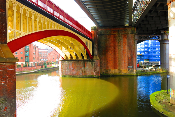
46. After walking beneath a road bridge, enter a section of the canal with a narrow towpath on the left.
More information.
On the far side of the canal is “Deansgate Arches” – a collection of bars and nightclubs built into arches beneath a former railway above, which now carries the Metrolink.
Deansgate Arches

Deansgate Arches
Deansgate Arches
47. At the end of the arches, descend to the left of a lock into a tunnel which takes the canal beneath Deansgate, illuminated by small coloured lights. Emerge from the tunnel to see a perfectly straight stretch to the end of the Rochdale Canal at lock 92.
Pictures
Deansgate Tunnel
Deansgate Tunnel
48. At the lock, with a large pub “Duke’s 92” on the left and a lock keeper’s cottage on the right, cross the canal by the road bridge and then walk diagonally to the left, through the beer “garden” of a pub.
Pictures
Lock 92, Lock Keeper’s Cottage
Path through pub beer garden
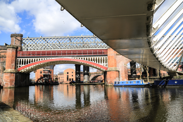
49. The route of the walk now crosses the large canal basin, at the junction of the Rochdale and Bridgewater canals. Before crossing that, explore the area to the right beneath several immense railway bridges, with several smaller footbridges over small canal arms.
More information.
This area is Castefield. It contains the, rather dull, remains of a Roman fort built c. AD80. It became an industrial area after the Bridgewater Canal was opened in 1764 and nearby, at what is now Manchester’s Museum of Science and Industry, the world’s first railway station opened in 1830. The area’s industries continued until the 1960s but then lost its purpose. In the 1980s a local bookmaker, Jim Ramsbottom, along with the City Council and the now-defunct Greater Manchester Council, mounted a very successful and early urban regeneration scheme, opening the area to tourists and visitors with numerous developments of apartments, offices, bars and restaurants.
Castlefield Bridges
50. Return to the basin and cross the large white arched bridge. At the far end of the bridge turn sharp left and walk back beneath the bridge to join the towpath of the Bridgewater Canal. The route now follows this until Throstle Nest Bridge, near Old Trafford.
More information.
This stretch of canal begins with industrial structures and modern apartment blocks on both sides. The towpath rises and falls over footbridges, crossing small canal arms. The railway and tram tracks run along high embankments and viaducts. After about half a mile the buildings are replaced by open sites, where old buildings were demolished but new developments have yet to begin. On the right, beneath the tram viaduct is the Pomona Lock which links the Bridgewater Canal to the complex of docks now known as Salford Quays.
Crossing the White Bridge
Under the white bridge
Bridgewater Canal at Pomona Tram stop
Under the white bridge
On the Bridgewater Canal towpath
51. At Throstle Nest Bridge, unmissable with its name in proud large letters, leave the towpath by walking up the ramp and then turn right to cross the bridge.
Picture
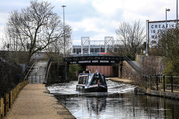
Throstle Nest Bridge
52. Cross the small slip road and then use the pedestrian crossing to find a way across the complex road junction of Trafford Road and Chester Road. Via several such crossings find your way to the entrance to Wharfside Way, with large warehouses on both sides and a large vertical chain sculpture.
Picture
Chain sculpture
53. Walk along Wharfside Way with views of Old Trafford Football Ground, home of Manchester United, appearing on the left. Turn left up Sir Matt Busby Way to visit the stadium (or not, depending on your prejudices.)
More information.
The Sir Matt Busby Way end of the stadium has some fine statues of Sir Matt and of former United players. An extended visit could involve a walk around the outside of the stadium, mostly in an uninteresting covered roadway. Stadium tours are possible.
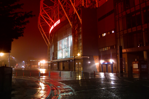
Old Trafford
54. Leave the Stadium by walking back down Sir Matt Busby Way. Cross Wharfside Way and Trafford Wharf Road and enter the Salford Quays complex to join the Quayside path. Turn left and follow the path along the side of the Quays.
More information.
These were formerly the Manchester Docks, opened in 1894 to create a new port 35 miles inland. They were served by the Manchester Ship Canal, built between 1887 and 1894 after decades of campaigning for a scheme to enable ships to bypass the Port of Liverpool. By 1903 Manchester was the fourth largest port in the country. It prospered until the 1950s when, under pressure from cheap foreign imports, the cotton industry in Manchester declined at the same time as containerisation of sea ports made Manchester’s uncompetitive.
Peel Holdings then bought the Ship Canal and large areas of land around. The subsequent Salford Quays redevelopment was led by major projects, such as the Trafford Centre shopping colossus, the Lowry Centre, the Imperial War Museum North and a mass of housing and office developments.
At the Eastern end of the Quays, near to where we join the quayside path and over to the right are some surprising low rise houses, built with a rural village character, early in the life of the project. Further west the housing projects are mostly high rise apartment buildings, of varying quality.
The walk along the quayside path has views of the Lowry Outlet shopping mall, with residential blocks and a large cinema on the far side of the broad dock basin. To its left, a footbridge crosses the dock to the Mall and the Lowry Centre. The footbridge lifts to allow ships to pass beneath. The Mersey Ferry Company operates occasional leisure cruises from Salford Quays to Liverpool, for which the bridge is lifted. The walk does not require us to cross this bridge but a short detour to see the Lowry Centre may be of interest.
The Lowry has an eccentric modern design, with geometric metal shapes. It houses two theatres and a gallery with a large collection of L. S. Lowry’s paintings. The theatres and gallery are quite successful but the interior’s bright colours and odd spaces make it somewhat uncomfortable and unappealing.
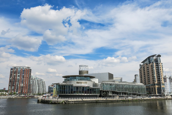
Salford Quays
55. Continue along the quayside opposite the Lowry, approaching the Imperial war Museum North, just beyond the footbridge, to the left.
More information.
Designed by Daniel Libeskind, the IWM is a massive metallic building, designed in the form of a shattered globe, offset by three shards, said to represent three theatres of war – earth, air and water. Admission is free. The exhibitions change from time to time and strike a good balance between, on the one hand, recognising the heroism and achievements – human and technical – involved in conducting war and giving clear accounts of the horror, tragedy and human folly of wars, on the other.
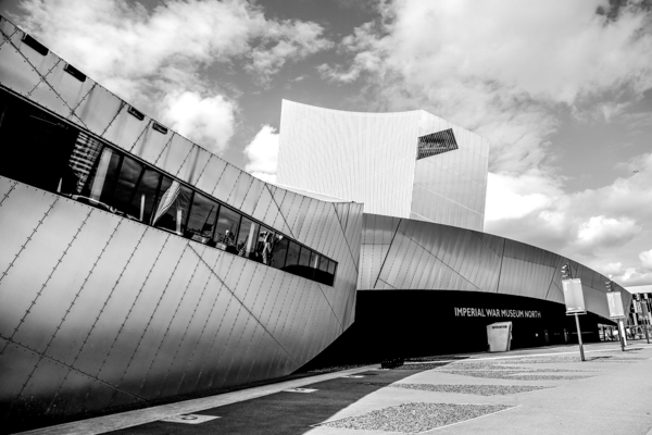
Imperial War Museum North
56. Walk along the quayside beyond the IWM.
More information.
Ahead and to the left is part of the Media City complex, developed at Salford Quays by Peel holdings in the early 21st Century. This first section is ITV, a complex of studios to replace the former Granada Studios in Central Manchester and containing the set for Coronation Street.
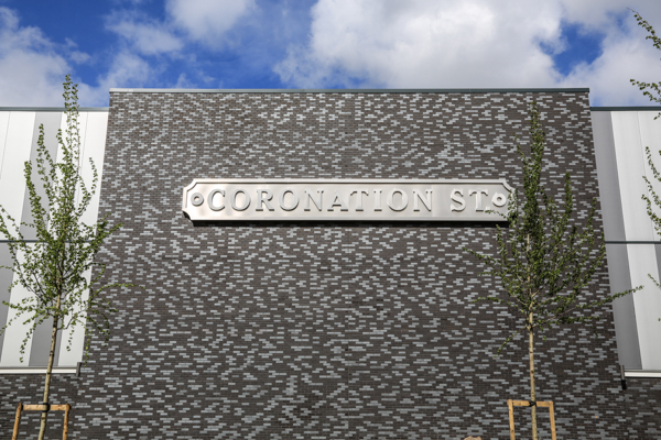
Granada Complex, Media City
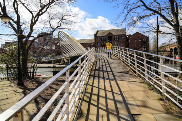
57. Cross the large footbridge, with eight large spikes supporting its suspending cables. This bridge swings to let ships through. On the far side walk between the Media City buildings, here mostly occupied by the BBC.
Picture
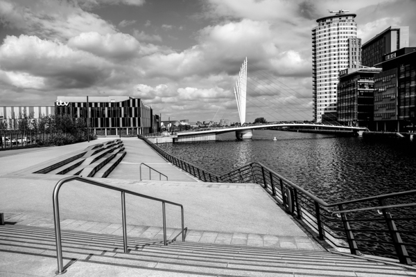
Footbridge to Media City
58. Walk out into a wide square, with studio and office buildings on two sides, a dock on another and, ahead of you, some tall posts with a large TV screen. Just beyond the screen, to its right, is the Media City UK Metrolink Stop, the “official” end point of this walk.
More information.
Walkers may wish to restore themselves by eating and or drinking in one of the bars and restaurants which have opened here since the BBC, ITV and other staff and residents moved-in.
Media City