Superlative Walks
Urban and rural trails, each with something very specialSALFORD DIRECTIONS
Salford is a City in Greater Manchester, approximately 1 mile west of Manchester City Centre, in a meander of the River Irwell which forms part of its boundary with the city of Manchester. Salford was the judicial seat of the ancient hundred of Salfordshire. It was granted a charter by Ranulf de Blondeville, 6th Earl of Chester in about 1230, making Salford a free borough of greater cultural and commercial importance than its neighbour Manchester. Since the Industrial Revolution of the late 18th and early 19th centuries that position has been reversed.
Salford became a major cotton and silk spinning and weaving town and inland port on the Manchester Ship Canal in the 18th and 19th centuries. Industries declined in the 20th century, causing economic depression with regenerated inner-city areas like Salford Quays next to some of the most socially deprived areas in England.
Salford is home to the University of Salford and has seen several firsts, including the world’s first free public library and the first street to be lit by gas.
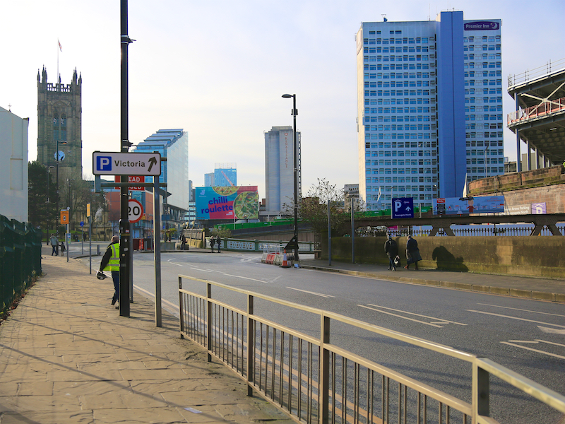
1. This walk starts at Manchester Victoria station. Leave the station on to Victoria Station approach and turn right towards the Manchester Arena and then left down Hunts Bank, by the Arena steps to Victoria Street. Turn left on to Victoria Street and then, at the start of the pedestrianised area, before reaching Manchester Cathedral, bear right into Chapel Street, crossing the River Irwell.
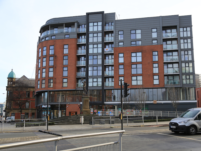
Chapel Street is a visually chaotic street where a number of old structures jostle for city space with a range of modern developments. This was one of the streets where poor living and working conditions were observed and recorded by Friedrich Engels in ‘Condition of the Working Class in England’ in 1844. The recent and continuing regeneration includes the 5-star Lowry Hotel.
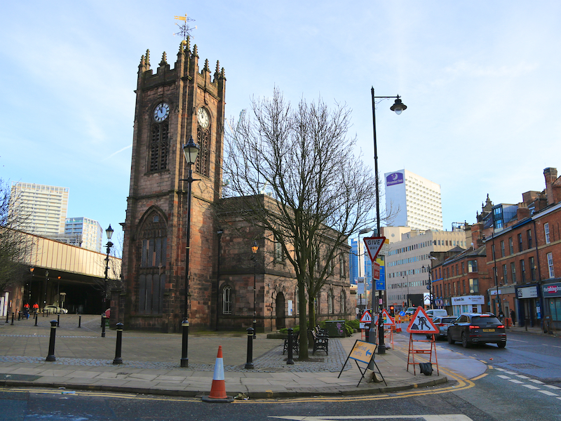
2. Walk along the right side of Chapel Street. At the junction with Blackfriars Street and Blackfriars Road cross at the pedestrian crossing to Sacred Trinity Church.
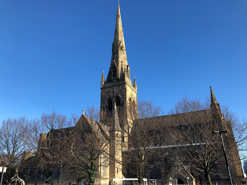
In 1806 Lee & Philips’ factory and a portion of Chapel Street were lit by gas – the first use of gas lighting in the world. Sacred Trinity Church is the oldest in Salford, founded by Humphrey Booth in 1635. In was the chapel after which the street was named although the current building dates from around a century later. John Wesley preached here in 1733 but when he visited 14 years later, he was refused admission and was chased out of town.
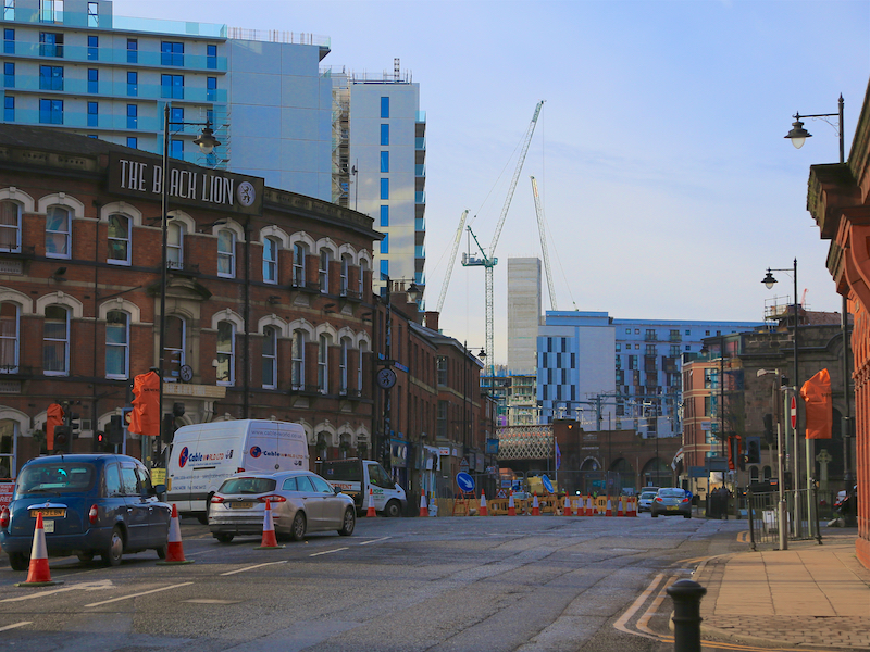
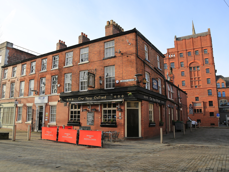
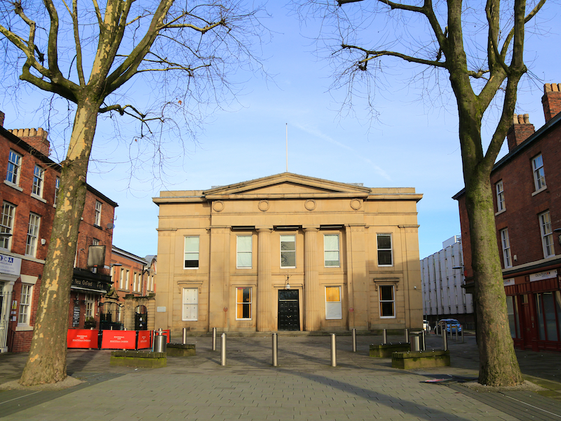
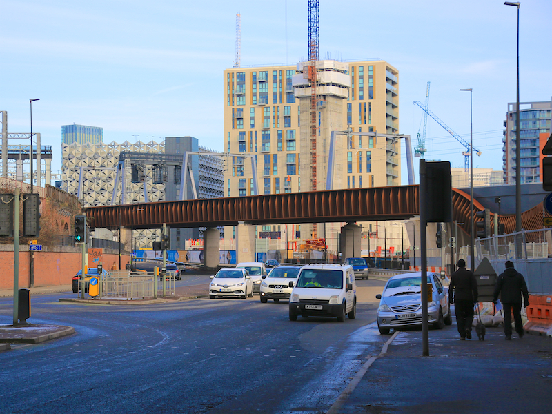
3. Continue along Chapel Street, under the railway bridge. At the busy junction with Trinity Way cross at the pedestrian crossing and continue past the old Salford Cinema building, now the New Manchester Church. Turn right into Bexley Square.
At the head of the square is the Old Town Hall. A red plaque commemorates the Battle of Bexley Square which took place on 1st October 1931 -“a poignant moment in history when Trade Unionists rallied to protect against injustice to the working class people of Salford.” 10,000 Salford people marched on the old Town Hall demanding no cuts to unemployment benefit, no cuts to teachers’ salaries, free coal for the unemployed in the winter, free milk for children under five and the abolition of ‘educational classes and training centres’. Chapel Street was cordoned off, and when organisers asked for a deputation to be allowed through to put their demands to the Council, the protesters were attacked by mounted police previously hidden behind the Town Hall. Meanwhile, plain clothes and uniformed police attacked the demonstrators with batons. The marchers included Walter Greenwood, author of “Love on the Dole” and a folk singer Jimmy Miller who later changed his name to Ewan MacColl.
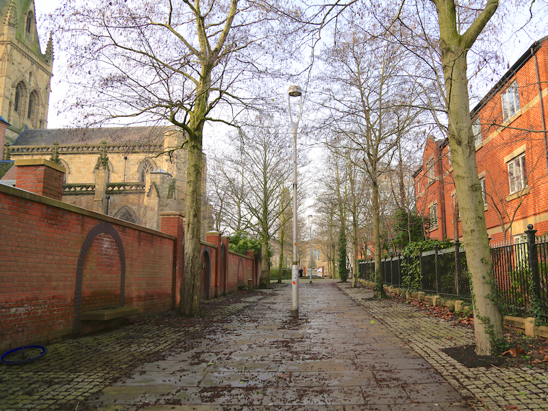
4. Leave Bexley Square to the left, turning right at the left side of the Town Hall, along Ford Street. Turn left along a pathway beside some modern apartments, past St John’s Square towards St Philip’s Square. Pass Salford Cathedral on the left.
Salford’s neo-gothic Catholic Cathedral, St John the Evangelist, was founded in 1844 financed mainly by two wealthy Catholic textile merchants, the Leeming family and the family of Daniel Lee.
St Philip’s Church is an Anglican parish church in Wilton Place, opened in 1824.The church was relaunched in 2016 as “Saint Philips Chapel Street”, described as an old church on a new journey.
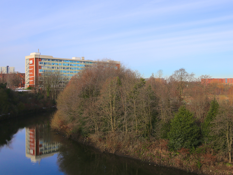
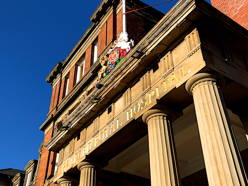
5. From St Philip’s, turn left, then right, then left to return to Chapel Street, turn right and continue past the former Salford Royal Hospital, straight on at the junction with Adelphi Street, towards the University of Salford campus, with the River Irwell in a valley on the right.
The original hospital in Salford was established in 1827, known as the Salford and Pendleton Dispensary. It became the Salford and Pendleton Royal Hospital and Dispensary in 1847 and the Salford Royal Hospital in the 1870s. In June 1941, during the Manchester Blitz, the hospital was struck by German bombs and 14 nurses died. Following the formation of the NHS Trust in 1990 and budget cuts imposed by the Government in the early 1990s, the hospital on Chapel Street closed in 1994 and was converted into luxury flats. A memorial stone tablet to commemorate the nurses killed during the blitz remains above the original Chapel Street entrance.
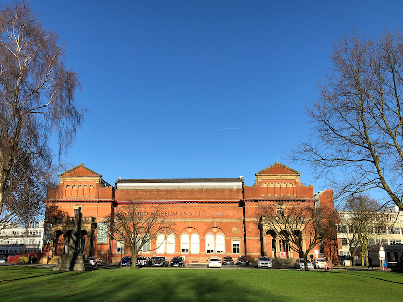
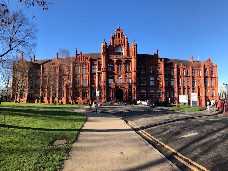
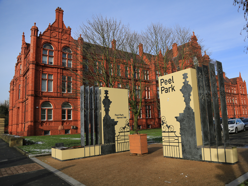
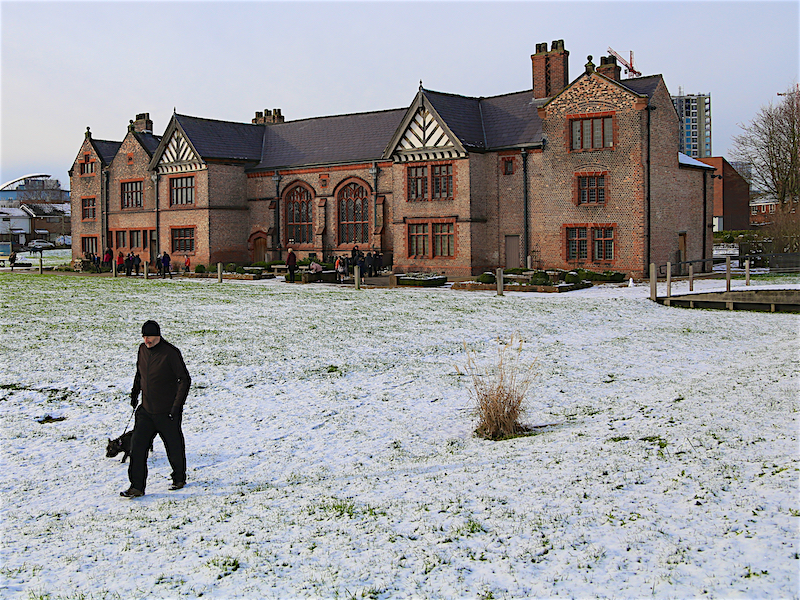
6. Pass the University’s Maxwell Building on the right and then turn right into the park at the entrance to the campus. On the far side of the green is the redbrick Peel Building. Go to the right of the Museum and Art Gallery.
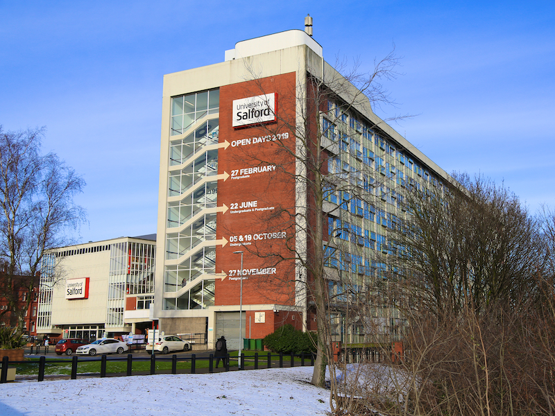
The university’s origins can be traced to 1896 with the opening of the Royal Technical Institute, Salford, a merger of Salford Working Men’s College founded in 1858 and Pendleton Mechanics’ Institute founded in 1850.
The Salford Museum and Art Gallery was opened in 1850 as the UK’s first free public library. The building was a mansion house known as Lark Hill, which had been built in the 1790s.
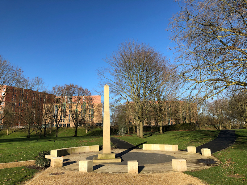
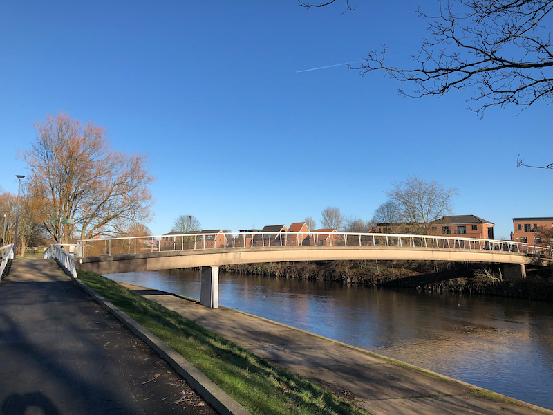
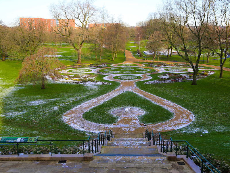
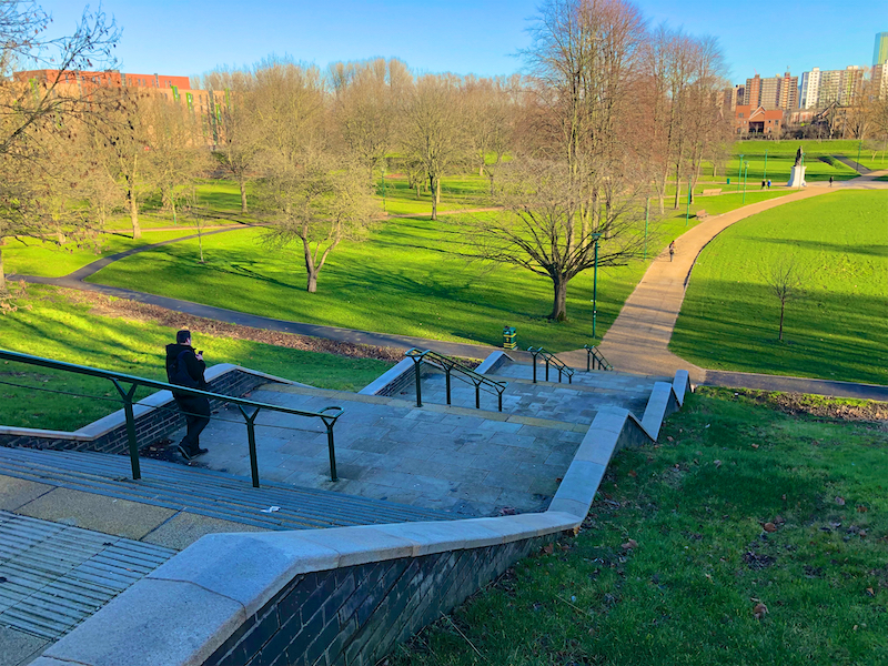
7. Walk to the right of the Museum and Art Gallery, to the left of some more modern buildings and turn left at the railings with a view down on to the extensive Peel Park. Descend the steps and walk anti-clockwise around the park noting the modern footbridge over the Irwell on the right. Turn left at the statue of Joseph Brotherton and to its rear the small obelisk.
Peel Park was the first of three public parks to be opened on 22 August 1846, for the people of Manchester and Salford, paid for by public subscription followed by Queen’s Park in Harpurhey and Philips Park in Bradford, Manchester. Peel Park, named in honour of Sir Robert Peel, is now said to be possibly the world’s first Public Park, although it may not even be the first public park in England as Derby Arboretum, which was given to Derby Town Council on 16 September 1840, claims this title. The park has been the subject of a number of paintings by the Salford artist, L S Lowry.
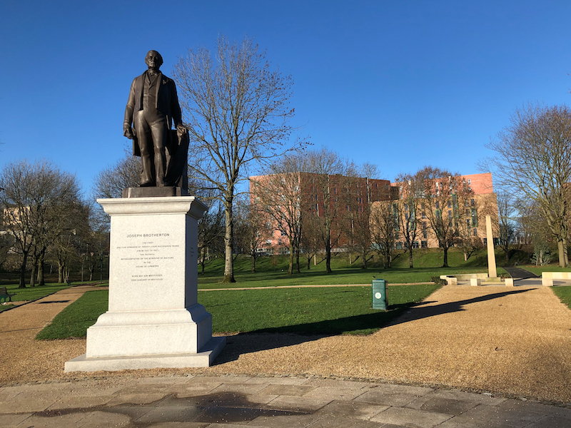
Joseph Brotherton was Salford’s first MP. Another statue of him can be seen on the Manchester Statues superlative walk. A cotton manufacturer and Salford’s MP from 1832, Brotherton campaigned against child labour and for improved working conditions in factories… [and] the creation of public parks, museums and libraries. He was… anti-slavery and considered the death penalty barbaric. He also argued eloquently the case for free non-denominational education… His wife Martha wrote the first widely used vegetarian cookbook in 1812.
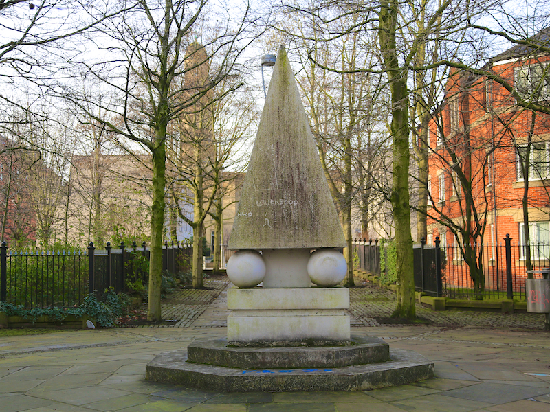
In November 1866 the River Irwell burst its banks, flooding much of Lower Broughton. The flood was said to be “more extensive and devastating in its effects than perhaps any that has occurred in this locality within the memory of living man”. Three men were drowned and many others, including the keeper of the park, had to be rescued from the upper storeys of their homes. As part of a general renovation of the park a granite flood obelisk was erected in 1867 with a flood marker on two faces showing the height of 8 feet 6 inches.
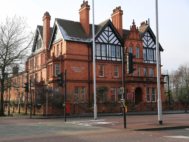
8. Continue past the Brotherton statue and the obelisk and climb steps up from the park towards some more university buildings on a rise. At the top of the steps turn left and follow paths, passing the Museum and Art Gallery on the left and the Peel building on the right. At the main road, The Crescent, cross to the far side to view the Working Class Movement library and turn left again.
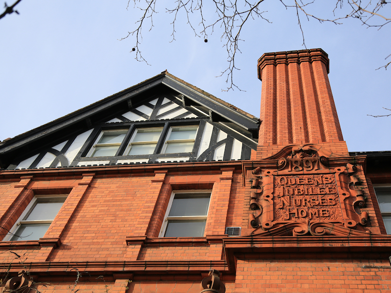
Across the main road from the Peel Building is Jubilee House, now home to the Working Class Movement Library. Jubilee House was built to mark the Diamond Jubilee of Queen Victoria’s reign. Work began on it in 1897. It is a three storey red brick building with mock-Elizabethan gabled ends, designed by the architect Henry Lord, and officially opened on 26th January, 1901. It began life as the Salford Royal Nurses’ Home and was where the nurses who were the pioneers to our district nurses resided. The Working Class Movement Library started life in the 1950s as the personal collection of Edmund and Ruth Frow. It became a Charitable Trust in 1971 and moved to its present home in 1987.
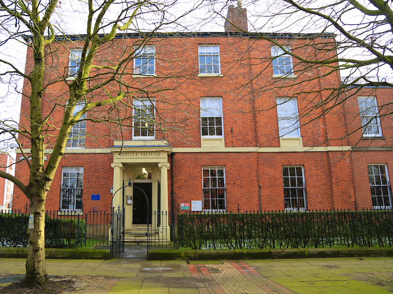
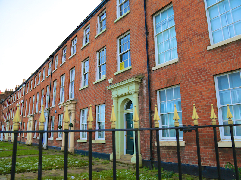
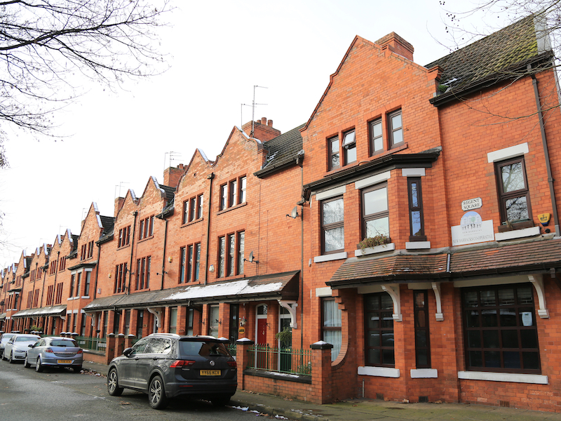
The next building on the left is Joule House, named after James Prescot Joule, who lived and worked here. Joule was a noted physicist who established the principle of the mechanical equivalent of heat. His name has been given to the unit of energy, the joule. To the left is The Crescent, said to be Salford’s most elegant street with a row of Georgian brick-built houses built in the 1820s, opposite the University Campus.
9. Walk along the Crescent to the junction opposite the Salford Royal Hospital building, and turn right into Oldfield Road. Follow Oldfield Road, past Sainsbury’s store, until the crossroads junction with Regent Road, cross Regent Road and turn right. Then turn left into Gloucester Street and almost immediately right into Coronation Street.
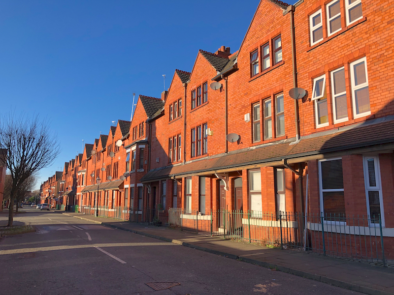
Coronation Street is a soap opera created by Granada Television and shown on ITV since 9 December 1960. The programme centres on life in a street in a fictional town, Weatherfield, based on inner-city Salford. In the show’s fictional history, the street was built in 1902 and named in honour of the coronation of King Edward VII. On 17 September 2010, it became the world’s longest-running television soap opera.
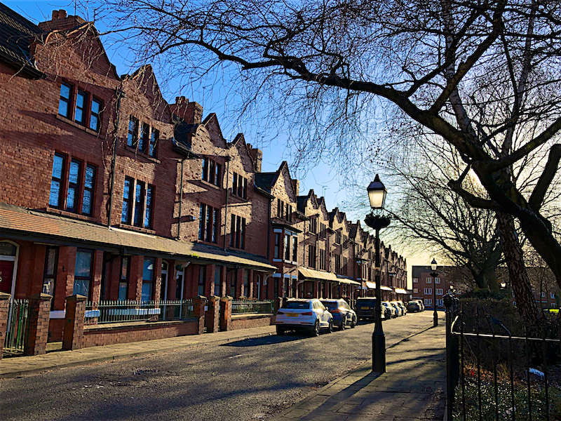
The writer, Tony Warren, had to alter the initial title of “Florizel Street”. The story goes that Agnes, the Granada tea-lady said it sounded like disinfectant. He then thought of Jubilee but there was already a series with that name, so he came up with Coronation Street, inspired by the real street of that name in Salford. The houses in the real Coronation Street are well-preserved and larger than those in the fictional street, original constructed at the Granada Studios complex in Water Street, Manchester, just half a mile away
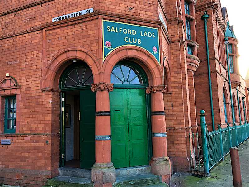
10. Walk along Coronation Street, passing Re=gent Square on the left to the far end, where on the left is the Salford Boys Club.
Salford Boys Club was purpose-built and opened in 1903. It became a listed building in 2003 and is considered by English Heritage to be the finest example of a pre-WW1 Lads Club. It is still open and operating as the Salford Lads and Girls Club. Famous former members include the actor Albert Finney, Eddie Colman, a Manchester United footballer killed in the Munich air disaster, rock star Graham Nash, of the Hollies and Crosby, Stills Nash and Young. and Peter Hook of Joy Division and New Order.
The club became famous when The Smiths posed outside for a photograph used on the cover of their 1986 album “The Queen is Dead” – which can be seen here: https://goo.gl/images/fukAZx
The club secretary was furious that the picture had been taken without his permission as well as the title of the album, he being a staunch royalist. In 2007, the Manchester Evening News reported that the building came third in a nationwide hunt to find the most iconic buildings in the country.
11. Return along Coronation Street and take the second right into Regent Square. On the far side of the square turn left along King Edward Street. Turn first right into Rudman Street (opposite Rudman Drive), right again into Tatton Street then first left on Belfort Drive. After about 120 metres turn right on Robert Hall Street, after 60 metres turn left into Browfield Avenue and after a further 130 metres turn left at the T-junction on Colman Gardens.
12. Turn immediately right into Grove Avenue passing St Clement’s Church, then left at the T-junction and then walk along the side of Ordsall Park and turn right through the park. At the far side of the park continue into Taylorson Street. Ahead and on the left, in a small park, is Ordsall Hall.
Ordsall Hall is a large former manor house in the historic parish of Ordsall. The name Ordsall has Old English origins being the personal name Ord and the word halh, meaning a corner or nook, which has become the modern dialect word “haugh”. This describes the position of the manor of Ordsall, for its boundary on the south side is a large bend in the River Irwell, which became the site of the docks for the Manchester Ship Canal. Ordsall first appears in records in 1177 when Ordeshala paid two marks towards an aid, a feudal due or tax.
The Hall dates back more than 750 years, although the oldest surviving parts of the present structure were built in the 15th century. The most important period of Ordsall Hall’s life was as the family seat of the Radclyffe family, who lived in the house for more than 300 years. The hall was the setting for William Harrison Ainsworth’s 1842 novel Guy Fawkes, written around the plausible although unsubstantiated local story that the Gunpowder Plot of 1605 was planned in the house.
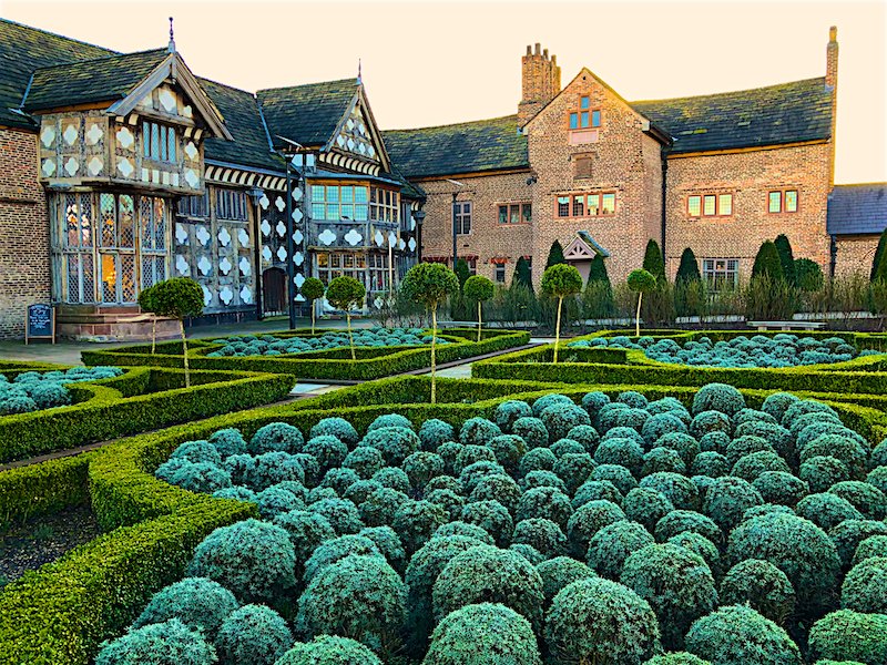
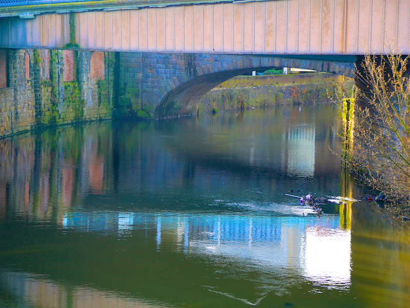
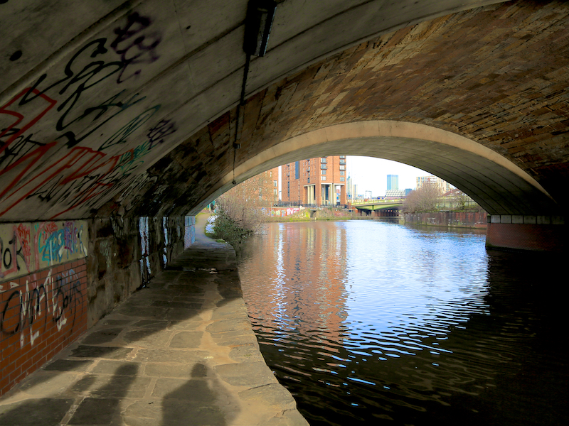
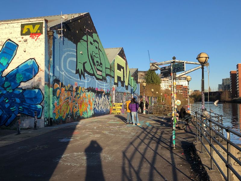
13. The Hall can be visited via its main entrance, through an ornate garden, from Taylorson Street. Leave the Hall by walking around to the left of the building and out through the car park and main gates on to Ordsall Lane. Cross the road and walk between modern, low level commercial buildings and down to the path alongside the River Irwell, which at this point becomes the Manchester Ship Canal.
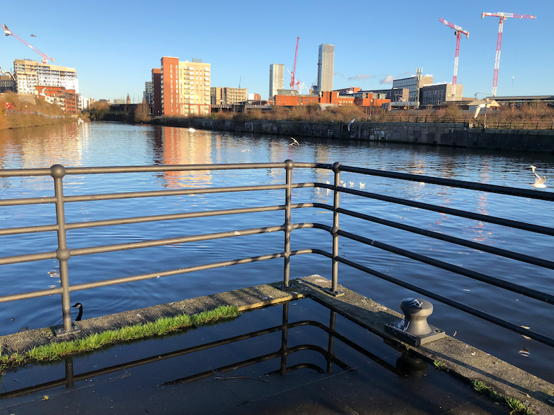
The Manchester Ship Canal is a 36-mile-long (58 km) inland waterway linking Manchester to the Irish Sea. Starting near Liverpool, it generally follows the original routes of the rivers Mersey and Irwell. Several sets of locks lift vessels about 60 feet (18 m) up to Manchester where the canal’s terminus was built. Major landmarks along its route include the Barton Swing Bridge the only swing aqueduct in the world, and Trafford Park the world’s first planned industrial estate and still the largest in Europe. Sadly, neither of these superlatives are visited on this walk.
Construction began in 1887; it took six years and cost £15 million (equivalent to about £1.65 billion in 2011). When the ship canal opened in January 1894 it was the largest river navigation canal in the world, and enabled the newly created Port of Manchester to become Britain’s third busiest port despite the city being about 40 miles (64 km) inland. Changes to shipping methods and the growth of containerisation during the 1970s and 80s meant that many ships were now too big to use the canal and traffic declined, resulting in the closure of the terminal docks at Salford.
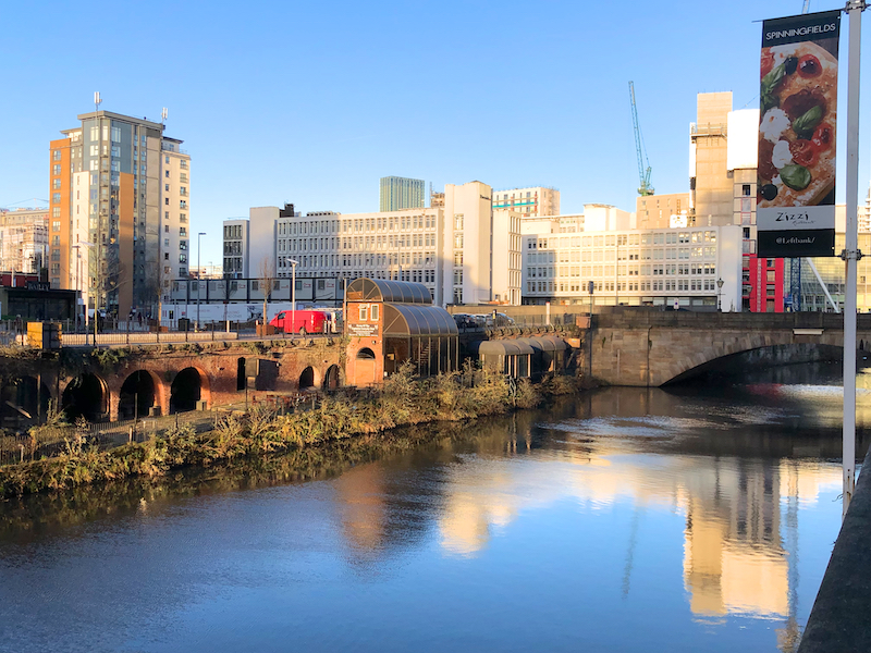
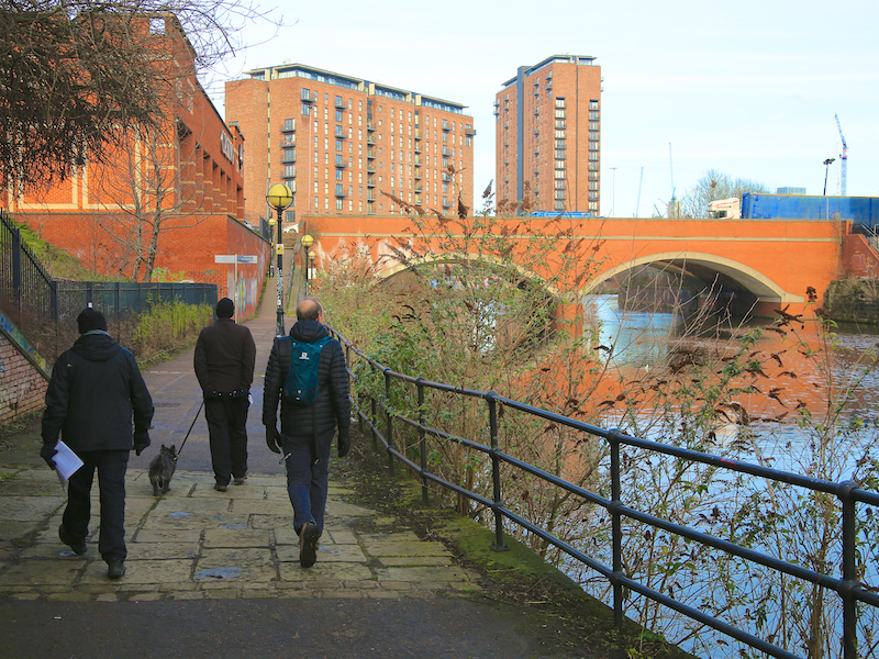
14. Turn left and follow the path along the banks of the canal/River. A project to restore/construct a pleasant walkway along the Irwell is well underway. At the time of writing this walk, the path is closed after Regent Road and just before the Trinity Bridge. Leave the path to the left here and turn right. Walk along Trinity Way to the junction with Irwell Street. Turn right and cross the bridge. Just beyond the far side of the bridge cross the road and turn left on to another riverside walkway, on the edge of the Spinningfields business district.
Spinningfields was developed in the 2000s between Deansgate and the River Irwell. The £1.5 billion project consists of twenty new buildings, totalling approximately 430,000 sq. metres of commercial, residential and retail space. It takes its name from Spinningfield, a narrow street which ran westwards from Deansgate.
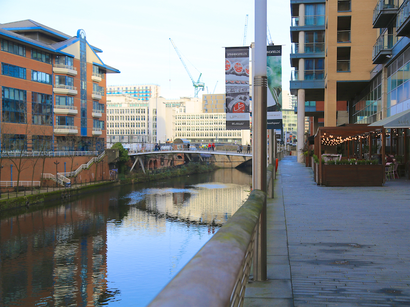
15. Walk along the riverside walkway with a series of bars and restaurants on the right, including the Dockyard, which serves good beer, vegetarian and meaty food and is dog friendly. Leave the riverside by the People’s History Museum and walk up on to Bridge Street. Turn left across the bridge and pass Salford Central station on the left. Turn right into Chapel Street. Then retrace the route to Victoria Station as in instructions 2 and 1 above.