Superlative Walks
Urban and rural trails, each with something very specialLiverpool Woolton
Directions
This walk explores the attractive Liverpool suburb of Woolton, particularly famous as the area where The Beatles’ John Lennon and Paul McCartney spent their childhoods, met and went on to form the group.
The best-selling band in history, the Beatles have sold more than 800 million physical and digital albums as of 2013. They have had more number-one albums on the UK charts, fifteen, and sold more singles in the UK, 21.9 million, than any other act. In 2004, Rolling Stone ranked the Beatles as the best artist of all time. They ranked number one on Billboard magazine’s list of the all-time most successful Hot 100 artists, released in 2008 to celebrate the US singles chart’s 50th anniversary. As of 2017, they hold the record for most number-one hits on the Billboard Hot 100, with twenty. The Recording Industry Association of America certifies that the Beatles have sold 178 million units in the US, more than any other artist. They were collectively included in Time magazine’s compilation of the twentieth century’s 100 most influential people.
The walk starts at the car park of the Tesco store in Woolton. For those arriving by train, the nearest Railway Station is Liverpool South Parkway.
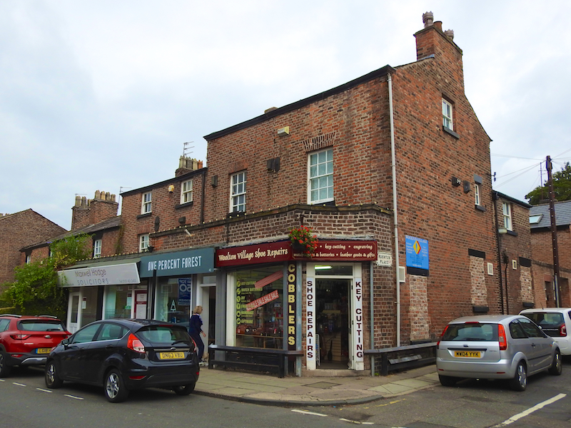
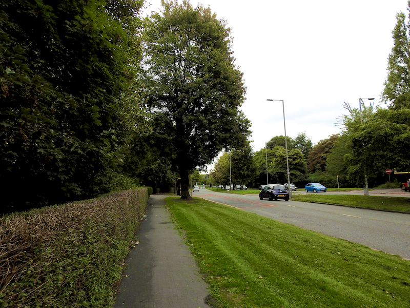
1. Leave the Tesco car park by walking back up the access road. Turn left at the traffic lights. Immediately fork left along Allerton Road into Woolton Village.
Originally a separate village, Woolton was incorporated into the City of Liverpool in 1913. The area was referred to as Uluentune in the Domesday Book, with the name translating as “farm of Wulfa”. Shortly after the Domesday survey, which was completed in 1086, Woolton became part of the Barony of Halton and Widnes. In 1189, a charge was granted by John, Constable of Chester, to the order of Knights of St. John of Jerusalem, a religious order who protected the routes for Christians who were on a pilgrimage to The Holy Land. These Knights Hospitallers held land in Woolton for over 350 years, until it was confiscated from them in 1559 by Queen Elizabeth I. The manorial rights to Woolton passed from Queen Elizabeth to James I who sold them to William Stanley, 6th Earl of Derby. Woolton then passed to Isaac Green, and through his daughter to her son Bamber Gascoyne of Childwall (MP for Liverpool 1780-96 and an ancestor of Bamber Gascoigne[ who hosted University Challenge for many years), and is now owned by the Marquess of Salisbury.
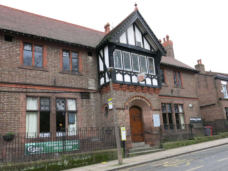
2. Continue past the Woolton Village Club on the right to the T junction at the end of Allerton Road. Turn left into Acrefield Road. Then turn left into Mason Street.
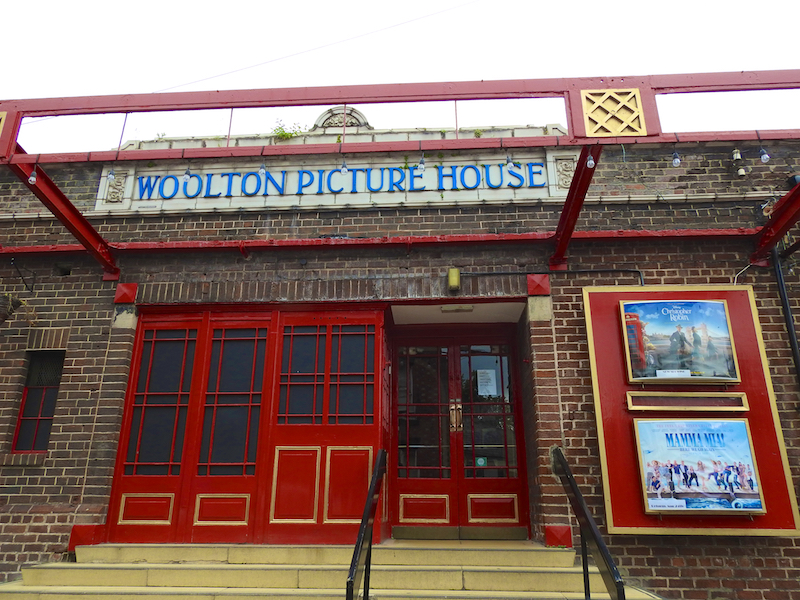
On the right of Mason Street is the Woollen Picture House. Woolton Picture House (also known as Woolton Cinema) is a privately owned cinema in the Woolton area of Liverpool, England.
Built in 1930, the auditorium originally held a seating capacity of over 800, composing of several rows of wooden benches. Remaining open throughout the war years, surviving the bombing raids of WW2, the cinema provided the local community a vital window to the front line, courtesy of Pathé newsreel. In 2006 the unexpected death of David Swindell the chief projectionist, followed shortly after by the death of the owner David Wood, lead to the closure of the cinema. In 2007 Woolton Picture House was purchased by a local business man and reopened, with a full house. In 2009 the cinema became the set for the film Nowhere Boy, a biopic of John Lennon’s adolescence and the creation of his first band The Quarrymen and its evolution into the Beatles.
Woolton Picture House is the only remaining single-screen cinema in the city, and is popular with cinema enthusiasts because of its old-fashioned atmosphere. The music of Mantovani plays before the main programme and in the traditional halfway interval, during which ice cream can be bought from usherettes.
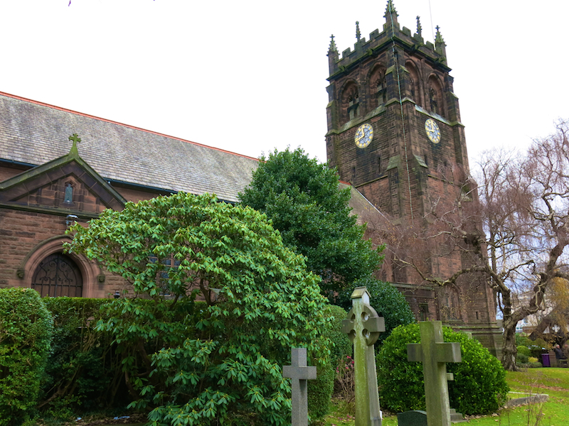
3. At the end of Mason Street, turn right up Church Road. Enter the churchyard of St Peter’s Church on the left.
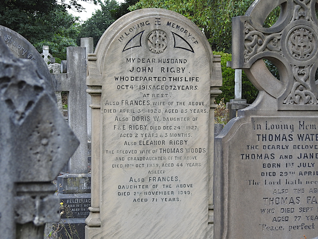
St Peter’s Church is in Church Road, Woolton. It is one of the largest parish churches in Liverpool, and its bell tower stands at the highest point of the city. It has two major Beatles connections: On 6 July 1957, John Lennon first met Paul McCartney in the church hall of St Peter’s when Lennon was playing with his group, The Quarrymen. McCartney eventually joined the group, which later became The Beatles. In the churchyard of St Peter’s is the grave of Eleanor Rigby, who became the subject for one of The Beatles’ songs.
“Eleanor Rigby” was released in 1966 . It was written primarily by Paul McCartney and credited to Lennon-McCartney. The song continued the transformation of the Beatles from a mainly rock and roll and pop-oriented act to a more experimental, studio-based band. With a double string quartet arrangemen and striking lyrics about loneliness, “Eleanor Rigby” broke sharply with popular music conventions, both musically and lyrically.
Also in the churchyard is the grave of Bob Paisley, footballer and manager of Liverpool FC, from 1974 to 1983. Paisley was the first person to manage three European Cup-winning sides. He also won an unprecedented six Manager of the Year Awards.
4. Leave the churchyard and turn left up Church Road. Turn left into Linkstor Road and follow it across the junction with Quarry Street to the T junction at the bottom of the hill. Turn left into Vale Road. Turn right into Evesham Close then follow the path through to Menlove Avenue.
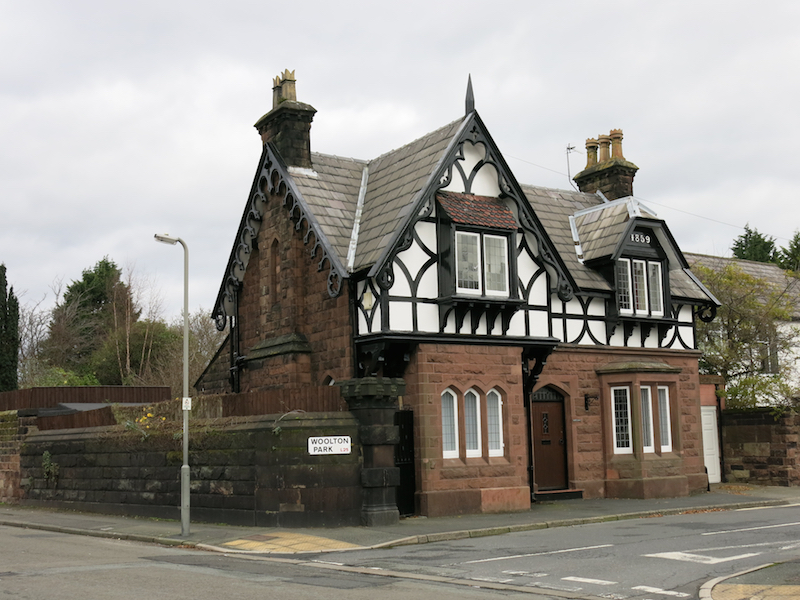
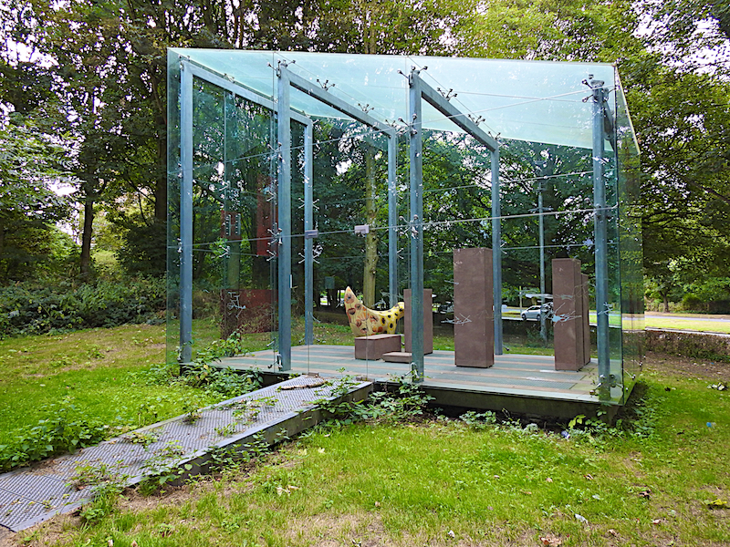
5. Turn left on to Menlove Avenue. Walk about 250 metres along the footway, past Rydecroft to “Outhouse” the small glass building set back a little from the road amongst trees.
Outhouse was designed by Vong Phaophanit and Claire Oboussier and promoted in 2005 by the Liverpool Housing Action Trust. It is intended to be a reduced version of new terraced houses built nearby.
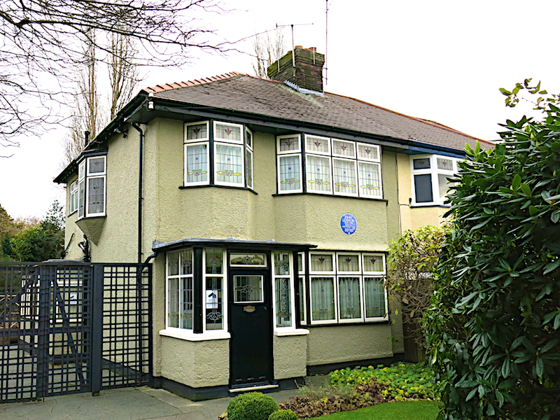
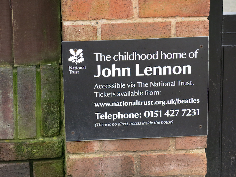
6. From Outhouse, return along Menlove Avenue, past Rydecroft and Lymecroft to “Mendips” at 251 Menlove Avenue.
John Winston Ono Lennon (9 October 1940 – 8 December 1980) co-founded the Beatles. Throughout most of his childhood and adolescence, Lennon lived at Mendips with his Aunt Mimi and her husband who had no children of their own. As performer, writer or co-writer, Lennon had 25 number one singles in the US Hot 100 chart. His album sales in the US stand at 14 million units.
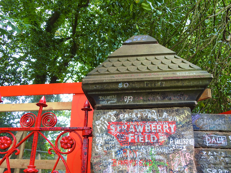
7. From Mendips, continue along Menlove Avenue, past the junction with Vale Road, and turn right up Beaconsfield Road. Walk up the right of this road for 200 metres to Strawberry Field.
Strawberry Field was the name of a children’s home close to John Lennon’s childhood home. Lennon and his friends used to play in the wooded garden behind the home. One of Lennon’s childhood treats was the Garden party held each summer in Calderstone’s Park near the home, where a Salvation Army brass band played. Lennon’s aunt Mimi recalled: “There was something about the place that always fascinated John. He could see it from his window … He used to hear the Salvation Army band [playing at the garden party], and he would pull me along, saying, ‘Hurry up, Mimi – we’re going to be late.
“Strawberry Fields Forever” was released by The Beatles in February 1967 as a double A side single with “Penny Lane“. The song was written by John Lennon but credited to the Lennon–McCartney songwriting partnership. The song was the first track recorded during the sessions for the Beatles’ Sgt. Pepper’s Lonely Hearts Club Band, starting in November 1966, and was intended for inclusion on the album. Instead, with pressure from their record company and management for new product, the group were forced to issue the single, and then adhered to their philosophy of omitting previously released singles from their albums. The double A-side peaked at number 2 on the charts, behind Englebert Humperdinck’s “Release Me” thereby breaking the band’s four-year run of chart-topping singles in the UK.
Lennon identified “Strawberry Fields Forever” as his highest achievement as a member of the Beatles. While the song initially divided and confused music critics and the group’s fans, it is one of the Beatles’ most influential works in the psychedelic rock genre.

8. Return down and cross to the right of Beaconsfield Road. Turn right into Menlove Avenue and cross the dual carriageway at the pedestrian crossing. Then turn right along the far side of Menlove Avenue. After about 800 metres, with Calderstones Park on the left, fork left into Calderstones Road. Continue for about 600 metres to Harthill Road.
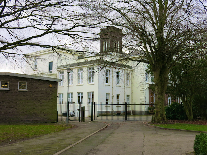
In Harthill Road is Calderstones School is a comprehensive school located opposite Calderstones Park. The school was founded in 1921 as Quarry Bank High School. John Lennon attended Quarry Bank and, whilst there formed his first band, taking their name from a line in the school song. Lennon started a skiffle group that was very briefly called the Blackjacks, but changed the name to The Quarrymen before any public performances. Some accounts credit Lennon with choosing the new name; other accounts credit his close friend Pete Shotton with suggesting the name. The Quarrymen played at parties, school dances, cinemas and amateur skiffle contests before Paul McCartney joined the band in October 1957. George Harrison joined in early 1958 at McCartney’s recommendation, though Lennon initially resisted because he felt Harrison (still 14 when he was first introduced to Lennon) to be too young. The group moved away from skiffle and towards rock and roll, causing several of the original members to leave. This left only a trio of Lennon, McCartney, and Harrison, who performed under several other names, including Johnny and the Moondogs and Japage 3 before returning to the Quarrymen name in 1959. In 1960, the group changed its name to the Beatles.
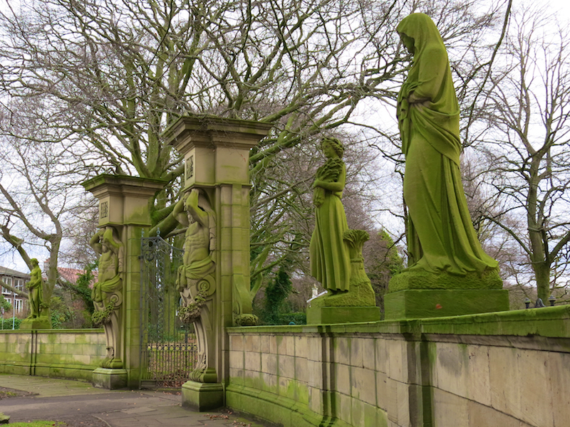
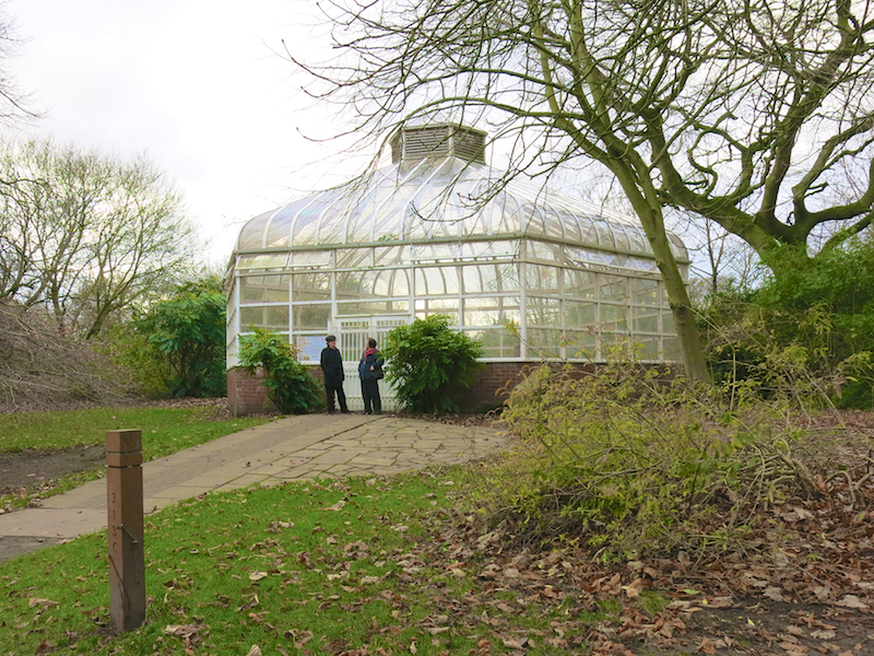
9. Enter Calderstones Park through the gates on the left with large statues. Follow the broad avenue into the park. After a bend to the left, visit the glazed building.
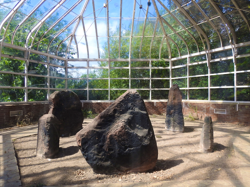
The Harthill Greenhouses contain the Calderstones are six neolithic sandstone boulders remaining from a dolmen. Little was known about the Calderstones until the 18th century when they are thought to have been disturbed. In 1825 it was reported that, “in digging about them, urns made of the coarsest clay, containing human dust and bones were found”.
The six surviving stones are of local sandstone and their sizes range from approximately eight by three feet to three and a half by two and a half feet. The markings which had been studied the previous century by Simpson were again analysed and moulds were made of the stones and carvings, which both enabled a precise record to be made and also highlight other worn carvings which were not previously visible. The carvings were placed into six categories; spirals, concentric circles, arcs, cup marks, cup and ring marks and footprints. There is also evidence of post-medieval and modern graffiti.
The stones were moved from their previous location in an enclosure just outside the park gates in 1954 to protect them from further weathering.
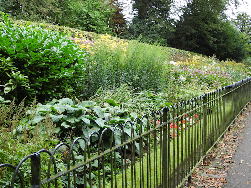
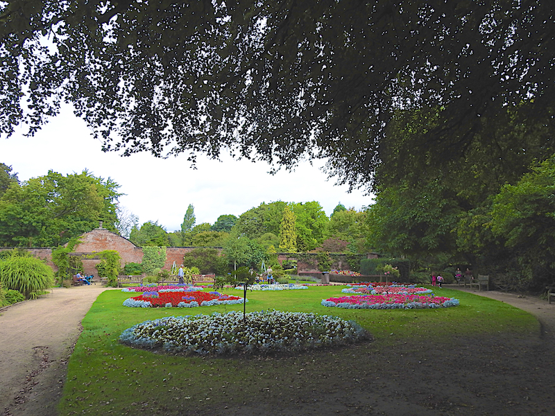
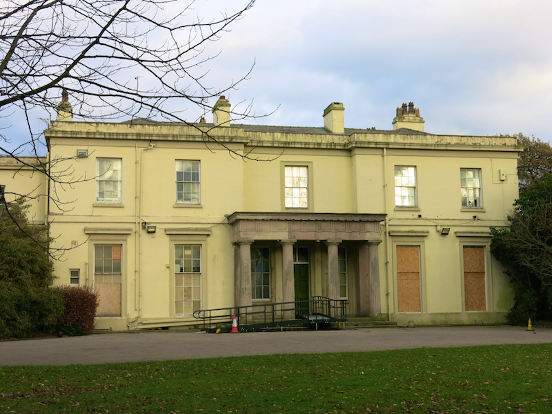
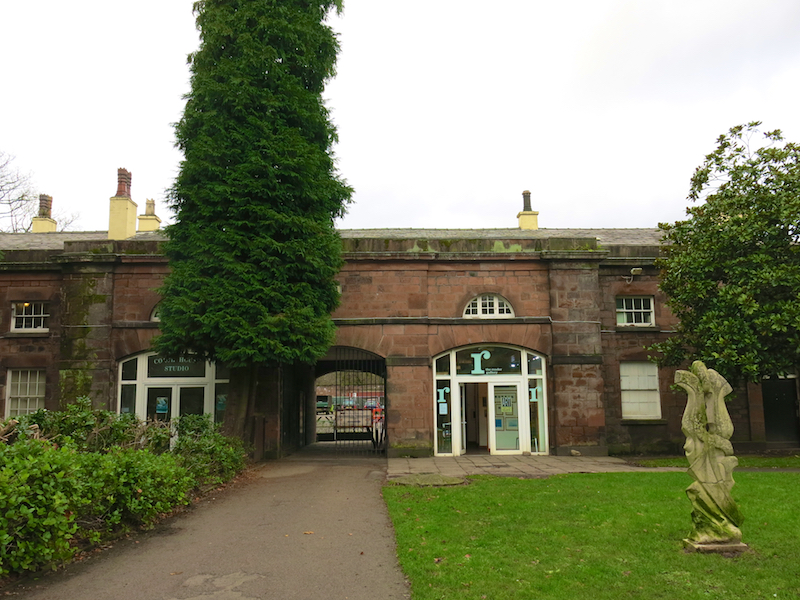
10. Continue along the avenue. Turn left at a crossroads towards the Mansion House. Pass the herbaceous border and walled garden on the left. At the Mansion House take the path on the left towards the Reader Gallery.
Since 2008, The Reader, with its headquarters in Calderstones Park, has pioneered the use of Shared Reading to improve well-being, reduce social isolation and build resilience in diverse communities across the UK and beyond. They inspire and support people to read great literature aloud together. This simple idea changes lives and builds communities. Groups worked-with include looked after children, people in recovery from substance mis-use, prisoners, individuals living with dementia, parents, teachers, people with mental and physical health conditions and many more. Their ambition is that Shared Reading will become so widespread that everyone, whoever they are, wherever they are, can access one of our groups. They aim to build a movement of Readers, so that Shared Reading will become part of everyday life.
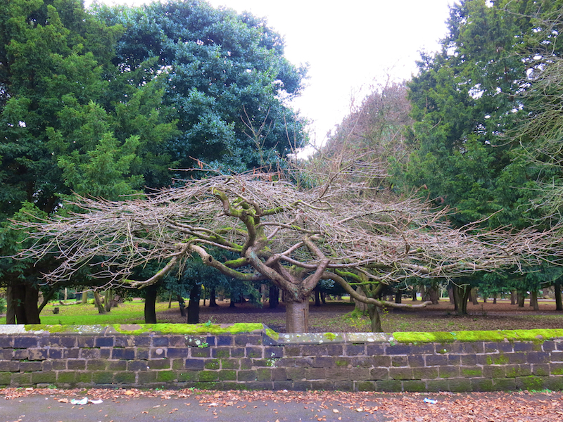
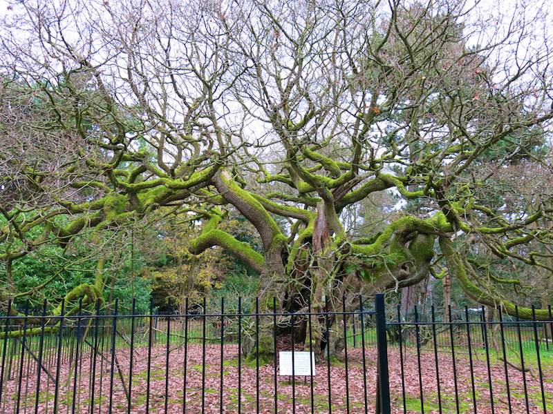
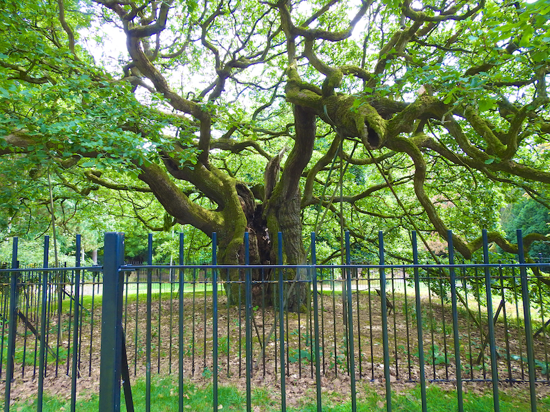
11. Opposite the Gallery take the path on the right. Follow the path round to the left then right to find the Allerton Oak, in a woodland area, surrounded by railings.
The Allerton Oak is estimated to be over 1,000 years old. According to legend the ancient local Hundred Court sat beneath its branches. Its dilapidated state is said to be due to the explosion of the gunpowder ship Lottie Sleigh over three miles away on the River Mersey in 1864. It is dependent upon a number of props that hold it up. Acorns and leaves from the oak were sent to soldiers by their families during World War II.
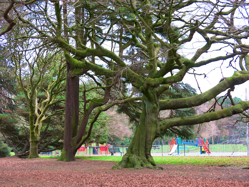
12. Return to the Mansion House. Follow the path to the left of the children’s playground then turn left along the broad avenue, past the small lake, set back on the left.
The playground is named after Linda McCartney, Paul McCartney’s late wife, which was officially opened by Paul on 19th July 1998. Paul also unveiled a plaque at the entrance, and planted a Cypress Oak tree (Quercus fastigiata) nearby overlooking the play area.
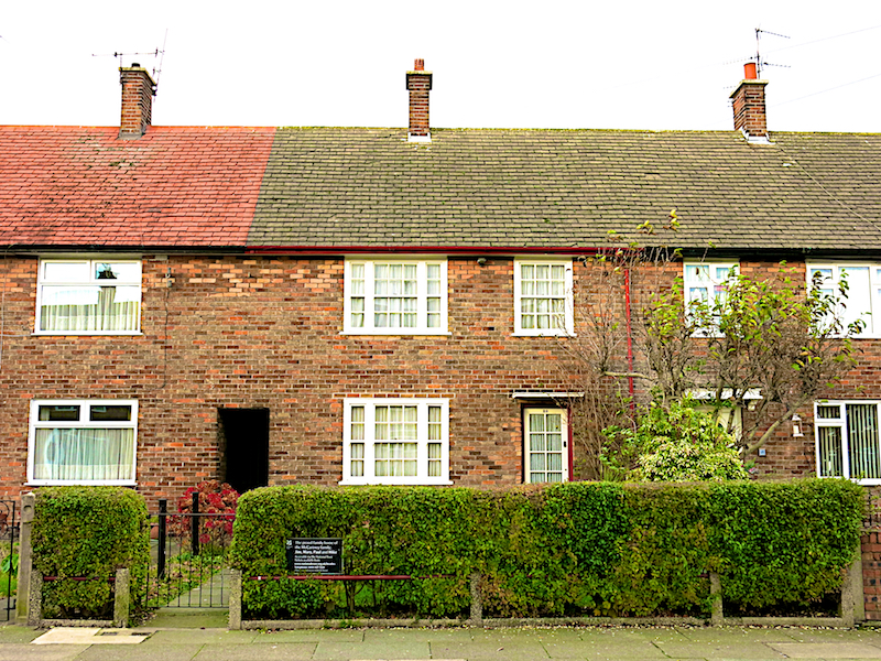
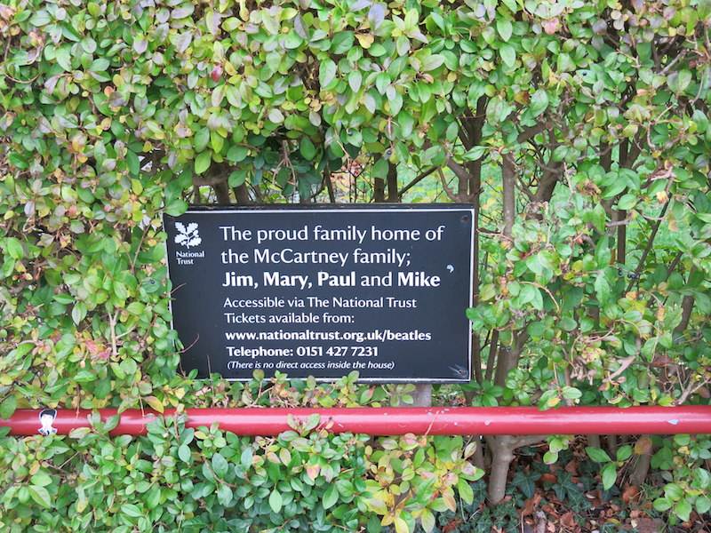
13. Follow the avenue to the park exit on Yew Tree Road. Turn right and follow Yew Tree Road, straight on at the junction with Allerton Road where it becomes Booker Avenue. At the crossroads, turn left into a dual carriageway, Mather Avenue. Cross to the far side of Mather Avenue and turn left. After passing the Merseyside police building, turn right into Forthlin Road and walk along its right side to 20 Forthlin Road.
20 Forthlin Road was the home of Paul McCartney from 1955. McCartney is one of the most successful composers and performers of all time. More than 2,200 artists have covered his Beatles song “Yesterday”, making it one of the most covered songs in popular music history. Wings’ 1977 release “Mull of Kintyre” is one of the all-time best-selling singles in the UK. In 1997, McCartney was Knighted for services to music.
14. Return to Mather Avenue. Cross to the far side of Mather Avenue and turn right. Turn left up Heath Road. At the T junction at the top of Heath Road, cross Allerton Road and follow the track opposite through woods. Continue straight on along this track, with Allerton Park Golf Club on the left. go straight on at a crossing of paths. Emerge from the track on Menlove Avenue.
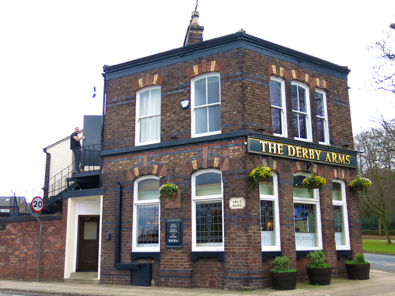
15. Cross Menlove Avenue and turn right, then left by the Derby Arms. Pass to the right of the Derby Arms, with or without stopping for refreshments. Turn left at the “Superstore” sign and return to the Tesco car park.